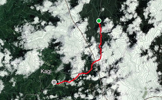
Define: Kokoda
- station town in the Oro Province of Papua New Guinea. It is famous as the northern end of the Kokoda Track, site of the eponymous Kokoda Track campaign of World War II. In that campaign, it had strategic significance because it had the only airfield along the Track. In the decades preceding, it had been a foothills settlement near the gold fields of the Yodda Valley.
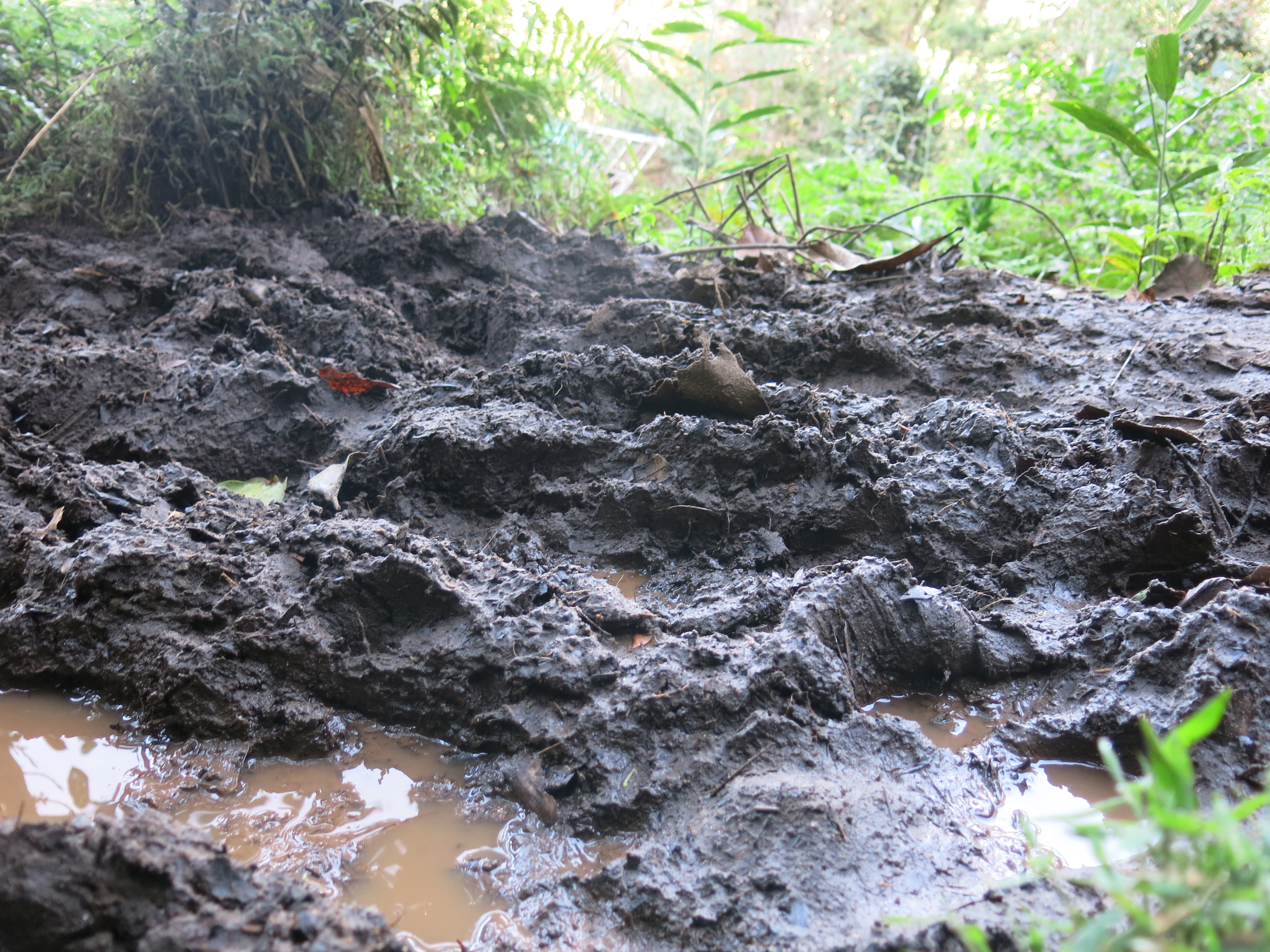
- relentless
NOTE: Throughout the next few paragraphs, I am in no way shape or form aiming to teach you any history nor is the intention of the below to discredit or dishonour anyone who has any connection, past or present, to this or any other war, battle or conflict. I am not a historian so apologies in advance if any facts I provide are incorrect.
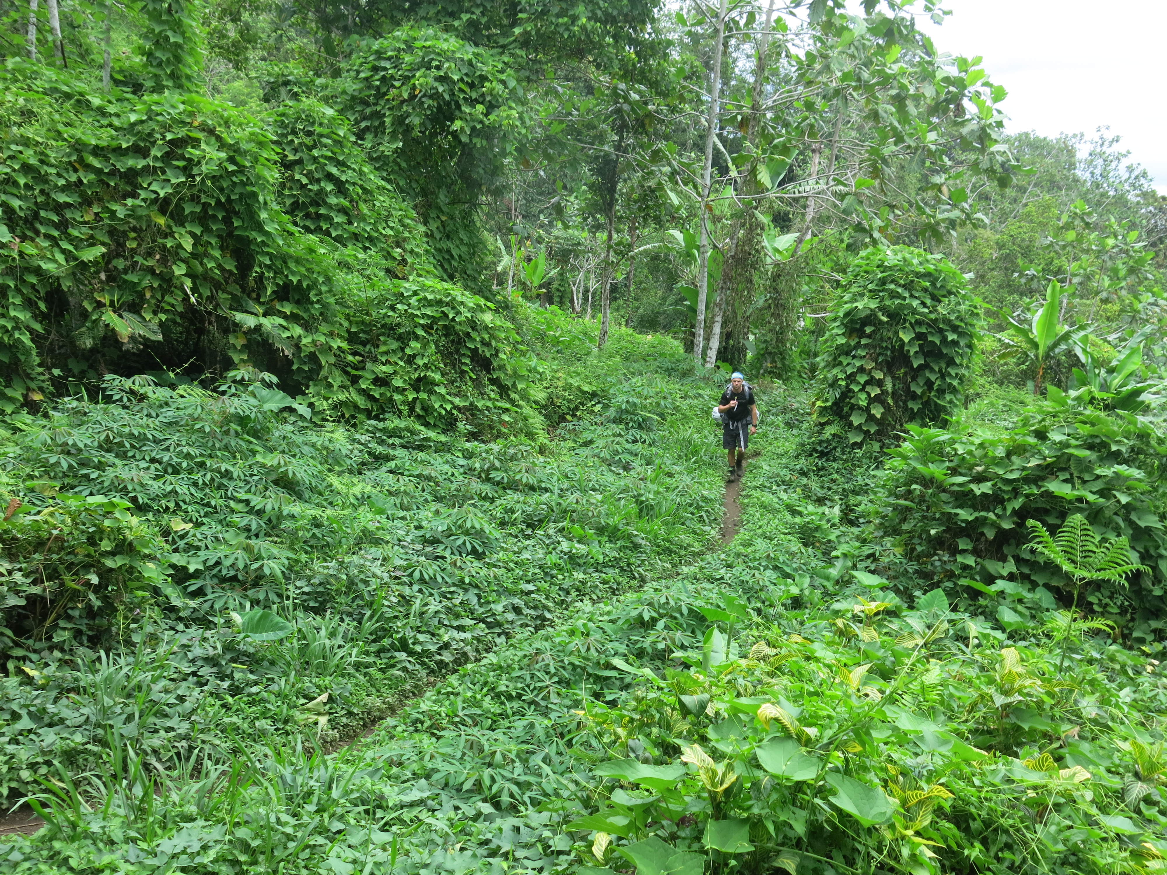
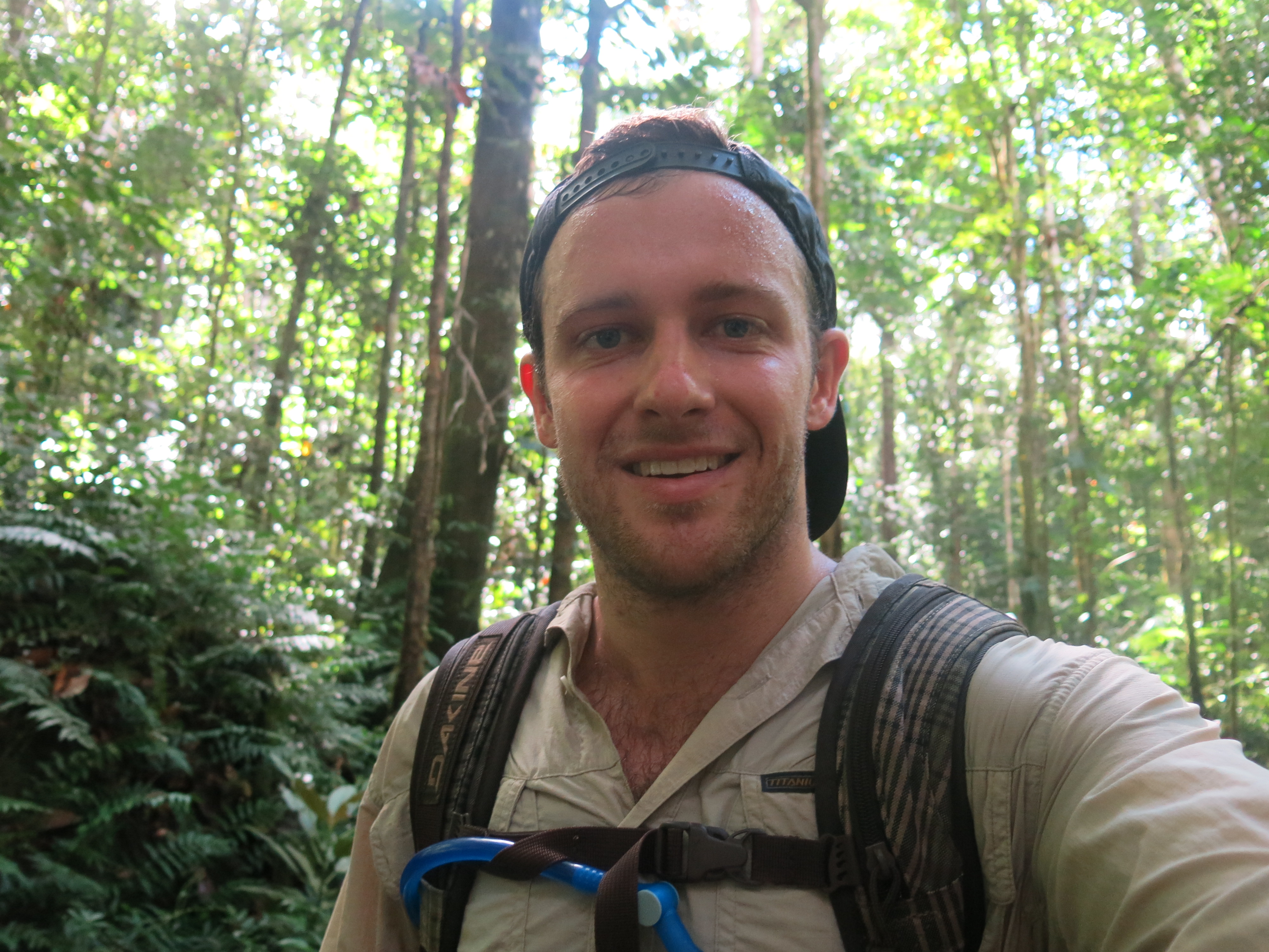
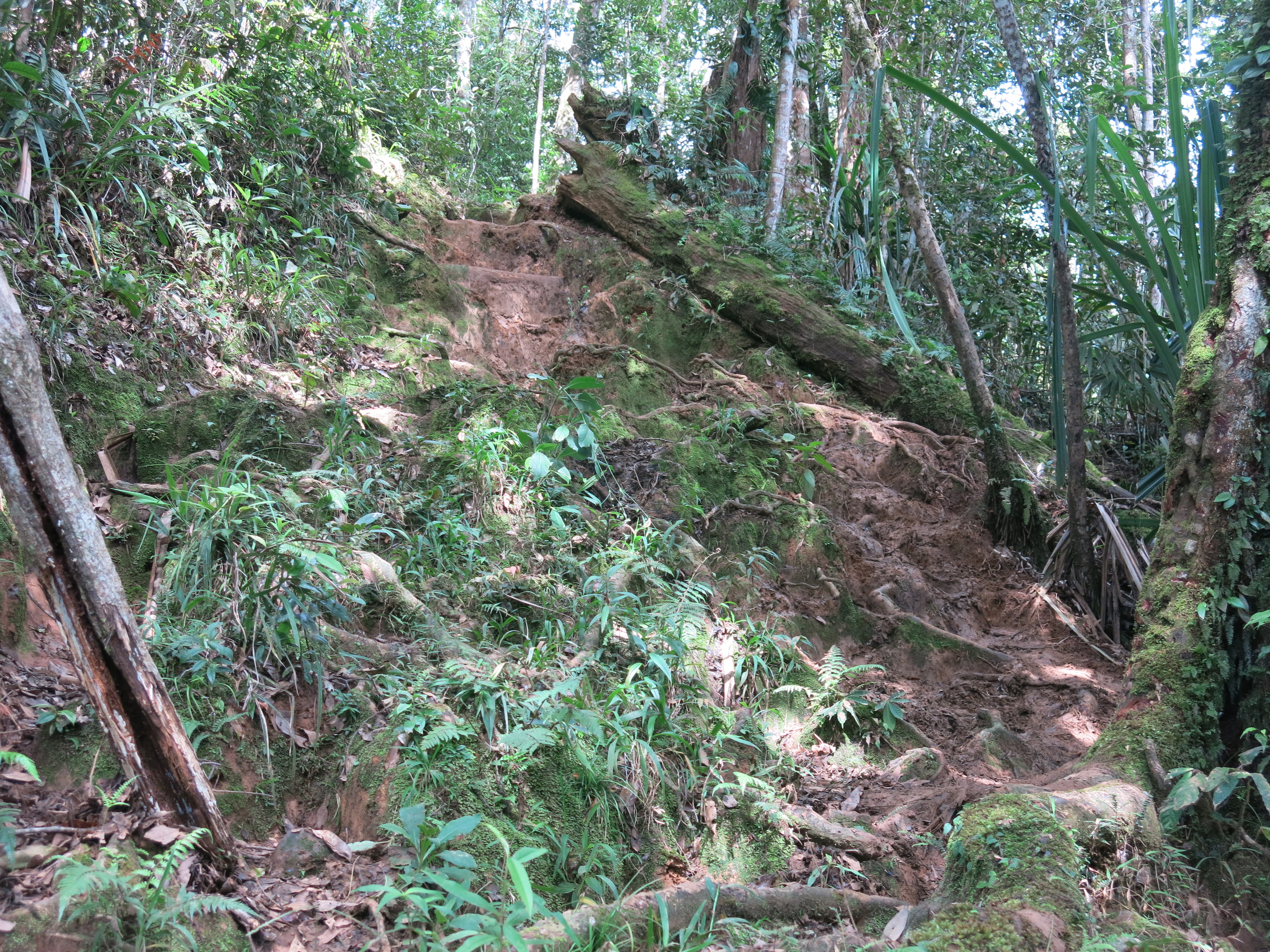
Trekking the Kokoda Track is by far the most physically demanding thing I have ever accomplished, not to mention the psychological toll the Track begun to play by the fifth day. You lose concentration on the Track for half a second and you are flat on your ass. That’s part of the psychological exhaustion. I struggle to comprehend how the Diggers and their Angels marched the Track multiple times back to back but have only the upmost admiration for them.
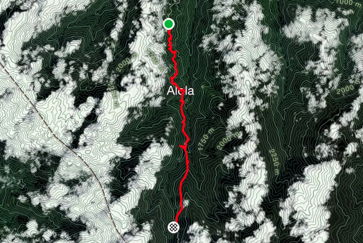
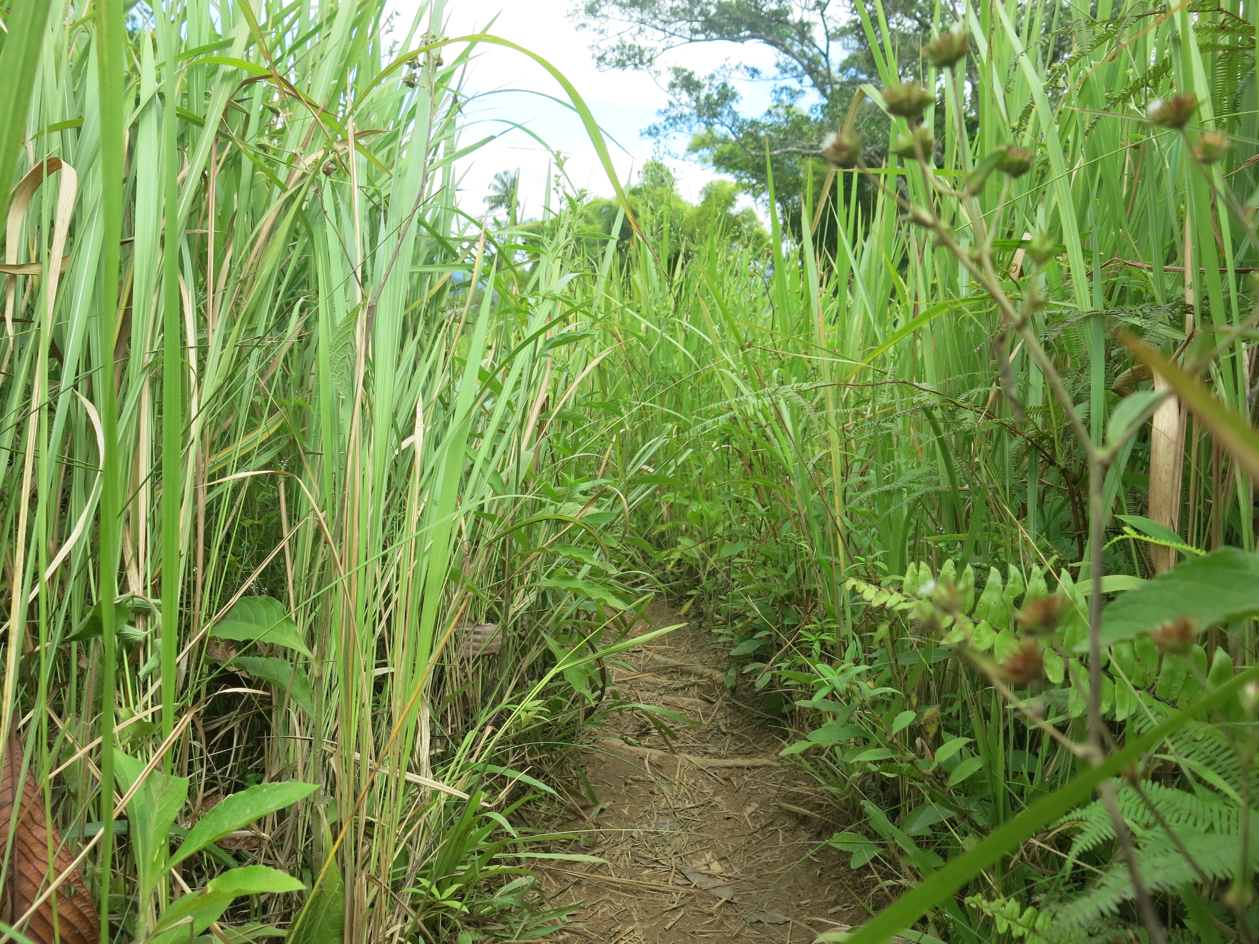
Over six days, I went on a journey to follow the campaign that occurred much too close to home, to our shores. Whilst other trekkers’ stories will be different, below is a breakdown of each day to give you a sense of my journey. It didn’t rain the entire trip but humidity sat around 80-85% and the temperature always above 30 degrees celsius. The locals said the trek was always easier in the rain because the conditions were not as hot.
Pre-Kokoda
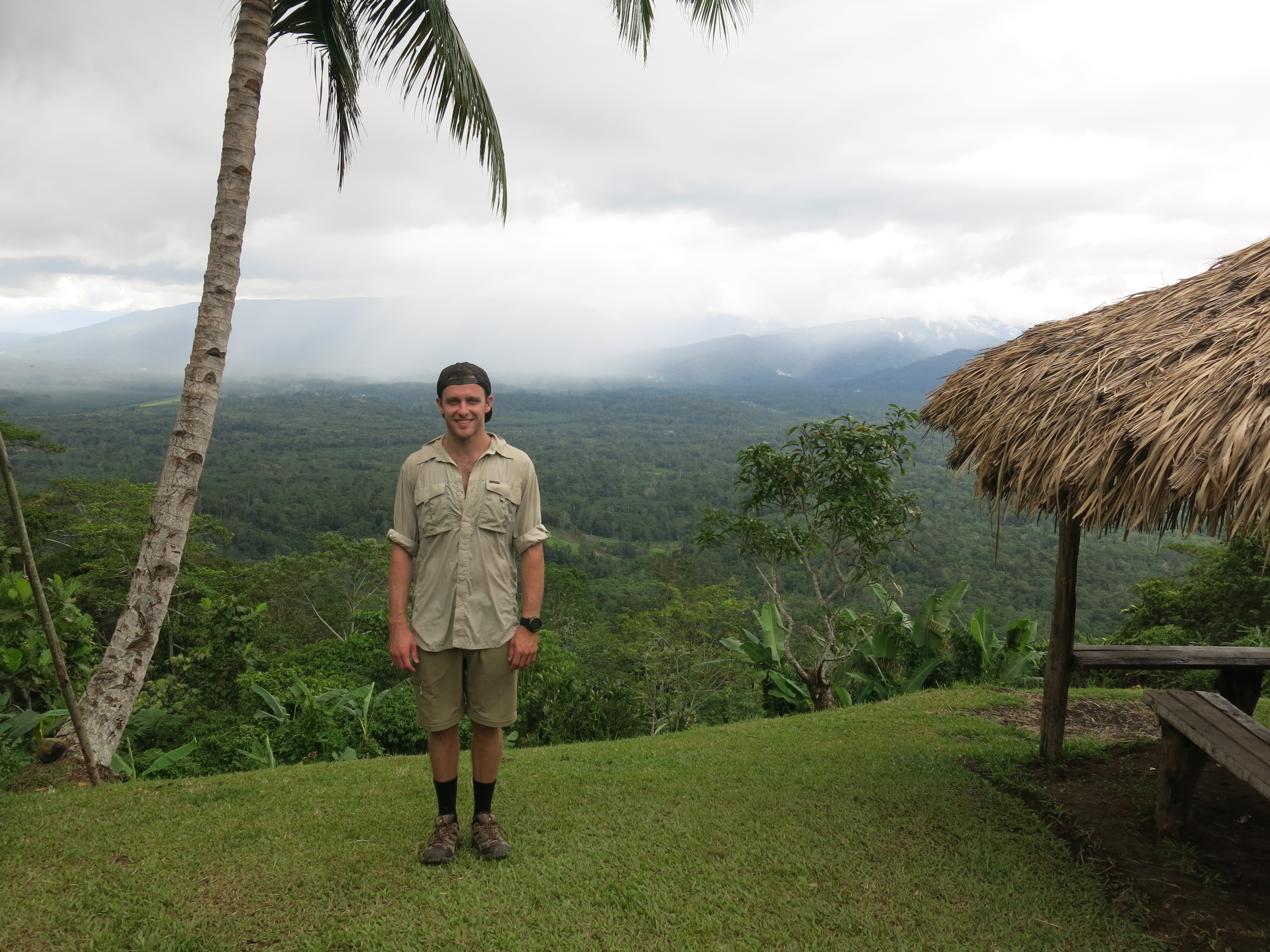
Only booking this trip four weeks ago, I had one third of the preparation time to stay fit and ready for a 6 day trek that is generally completed in 10 days.
First day of official training, a torn muscle in the right ankle. Not a great start and a recovery that was not completed before Day 1. I was entering the Owen Stanley Ranges injured.
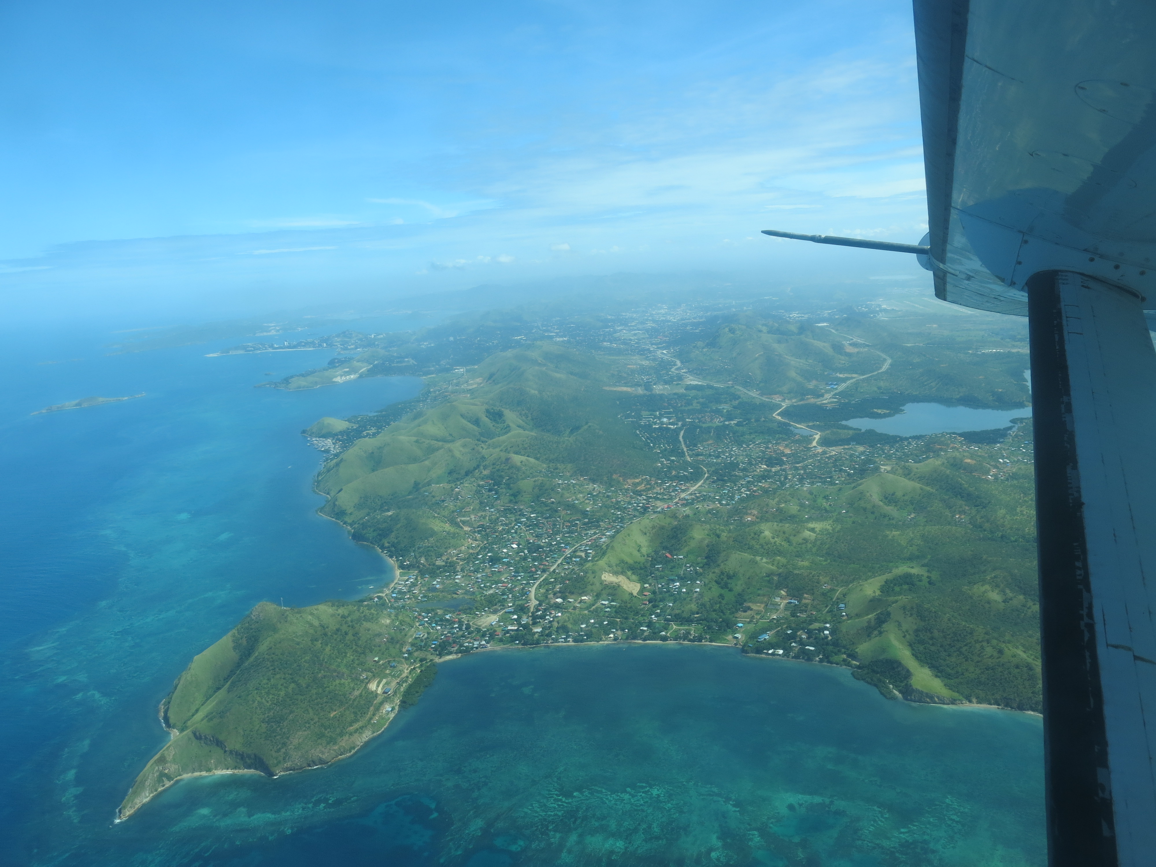
Flying Sydney to Port Moreseby
Always a story to tell because something always seems to happen to me on air travel. Not talking about the ‘random’ bomb check at the security check point I seem to be stopped for every trip, I’m talking about something else.
It was either extreme stupidity or faith in humanity. Not the 2.30am wake up to get to Sydney airport, the one thing I’ve told myself I’d never do. Brisbane airport. Rushing to the connecting flight to the capital city of Papua New Guinea. “Can you do me a favour?” asked the organiser of the tour company for the trek. “We need a GPS tracker picked up at Brissy airport and taken with you to PNG. The GPS tracker for your group has broken.”
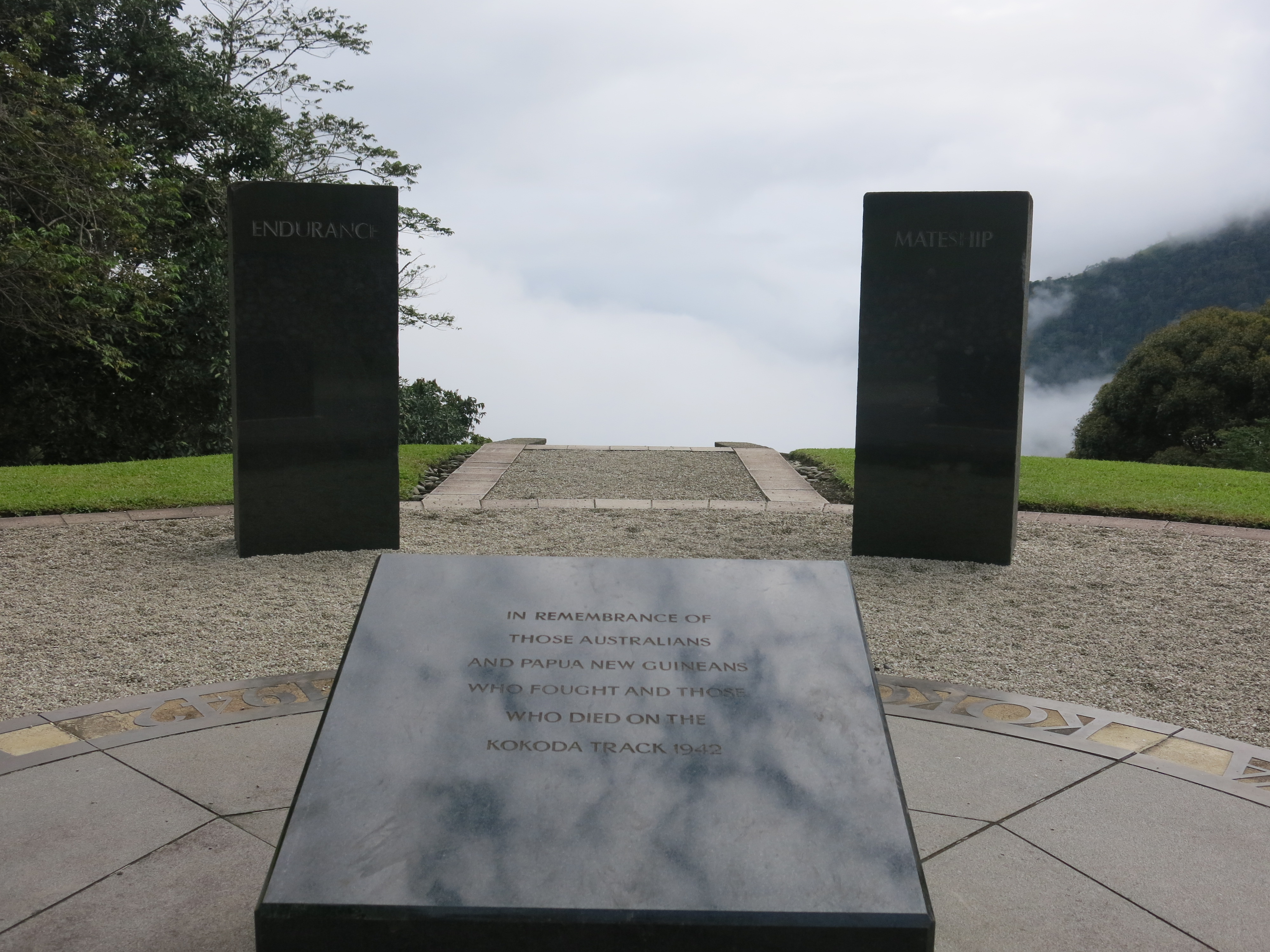
National Geographic’s program, ‘Banged Up Abroad’ instantly came to mind. This program tells the stories of travellers getting caught smuggling illicit goods across boarders. It wasn’t a particular part of the adventure I wanted to partake but I’d opened myself up to the prospect of ‘trying to be a good bloke and help out’. After all, the word MATESHIP was so prevalent in the expedition he was embarking.
Meeting with the mother of the organiser at Brissy airport, she handed over the GPS tracker. And this is where the stitch up really began. On top of the GPS tracker, I was also given a laptop, 3 car fan belts and an SLR camera to take to Moresby. You’re kidding… sweating bullets going through PNG customs, wondering what the inside of a Port Moresby jail looked like.
I either overreacted or got away with it – wasn’t sure which but at this point didn’t care. Never again.
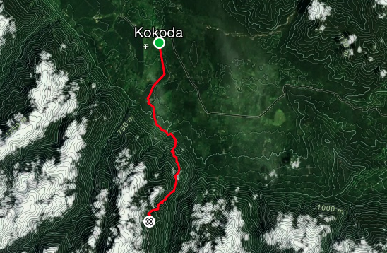
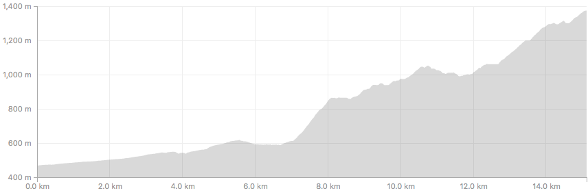
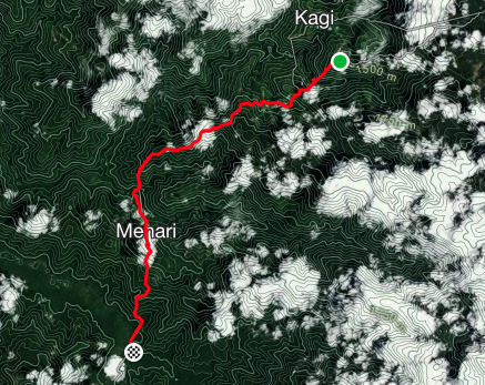
Day 1
Summary:
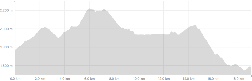
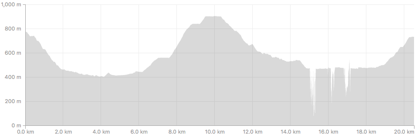
- Distance = 15. 12km
- Time = 5:29hrs
- Ascent = 1108m
- Descent = 194m
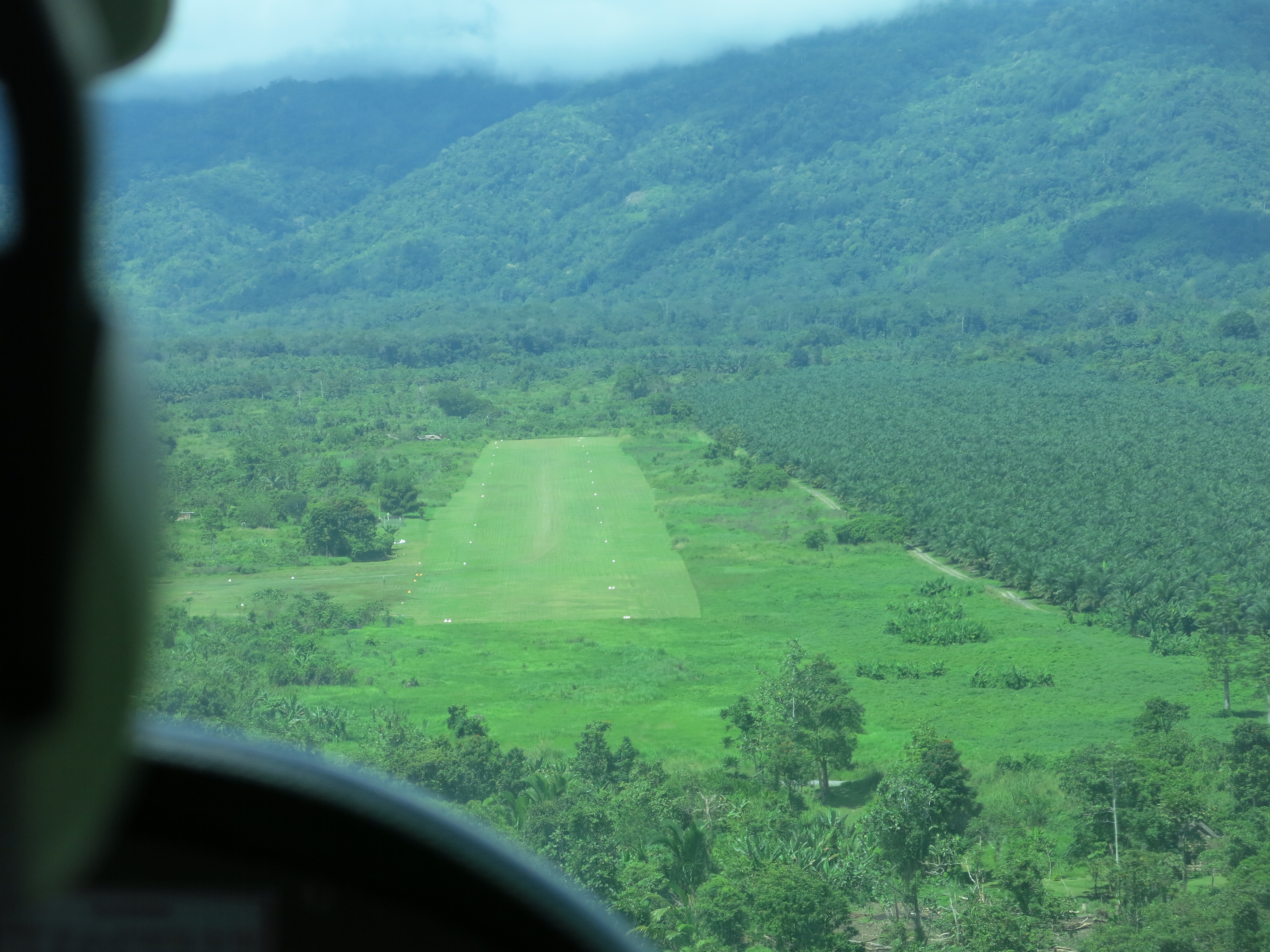
Papua New Guinean time is a thing. They live in the same time zone as Sydney, but when they say something like “the chartered plane will leave at 7.30am for Kokoda airport” what they really mean is that the trekkers will sit around in the sun for 3 hours before takeoff.
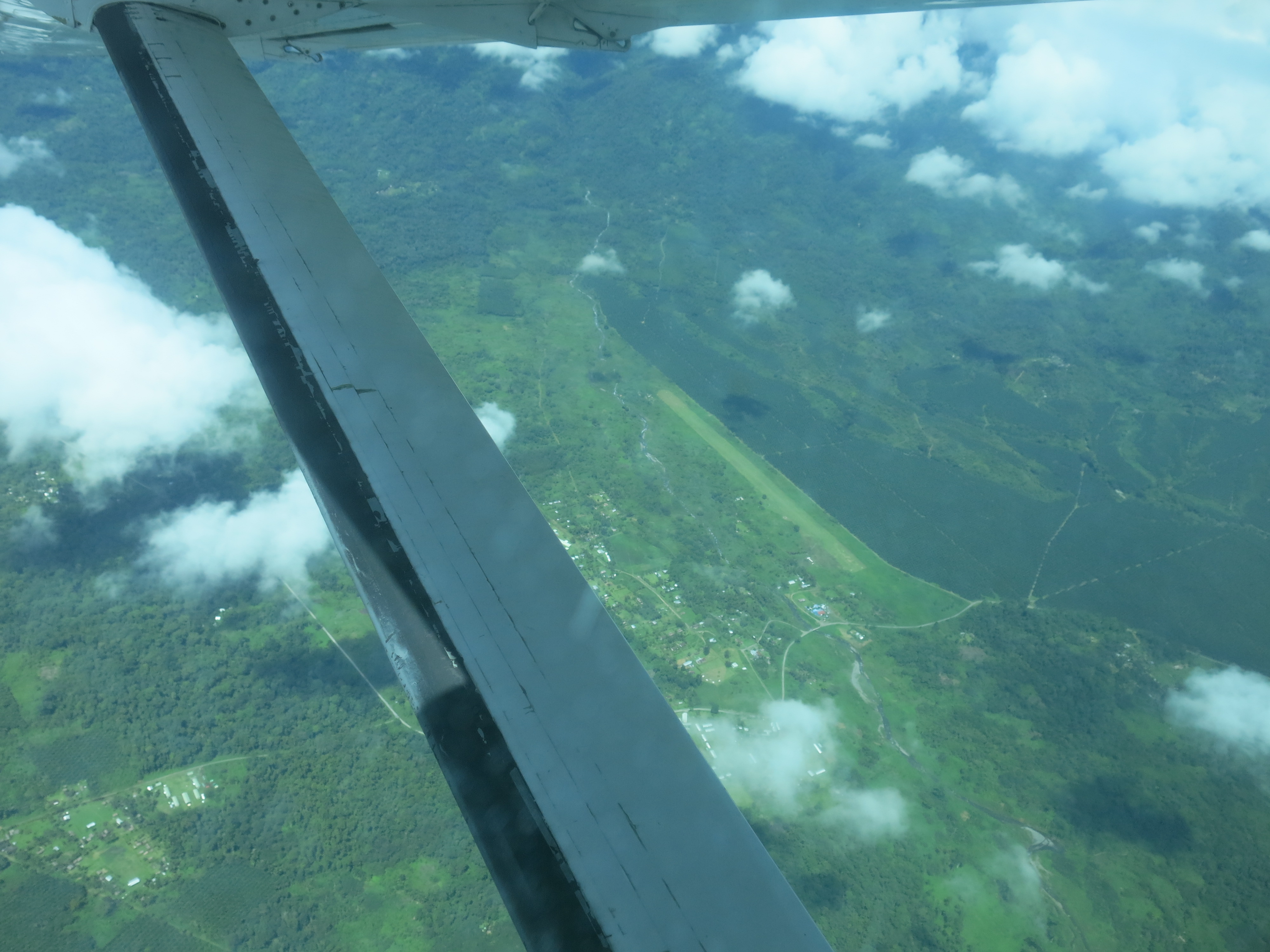
To paint the picture, the early morning fog nestling among the Ranges in Kokoda makes it difficult for the young pilot to land the 9-seater airplane on the soggy grass runway. The baggage handlers in Kokoda don’t wear shoes. In fact, not many people do and not out of choice.
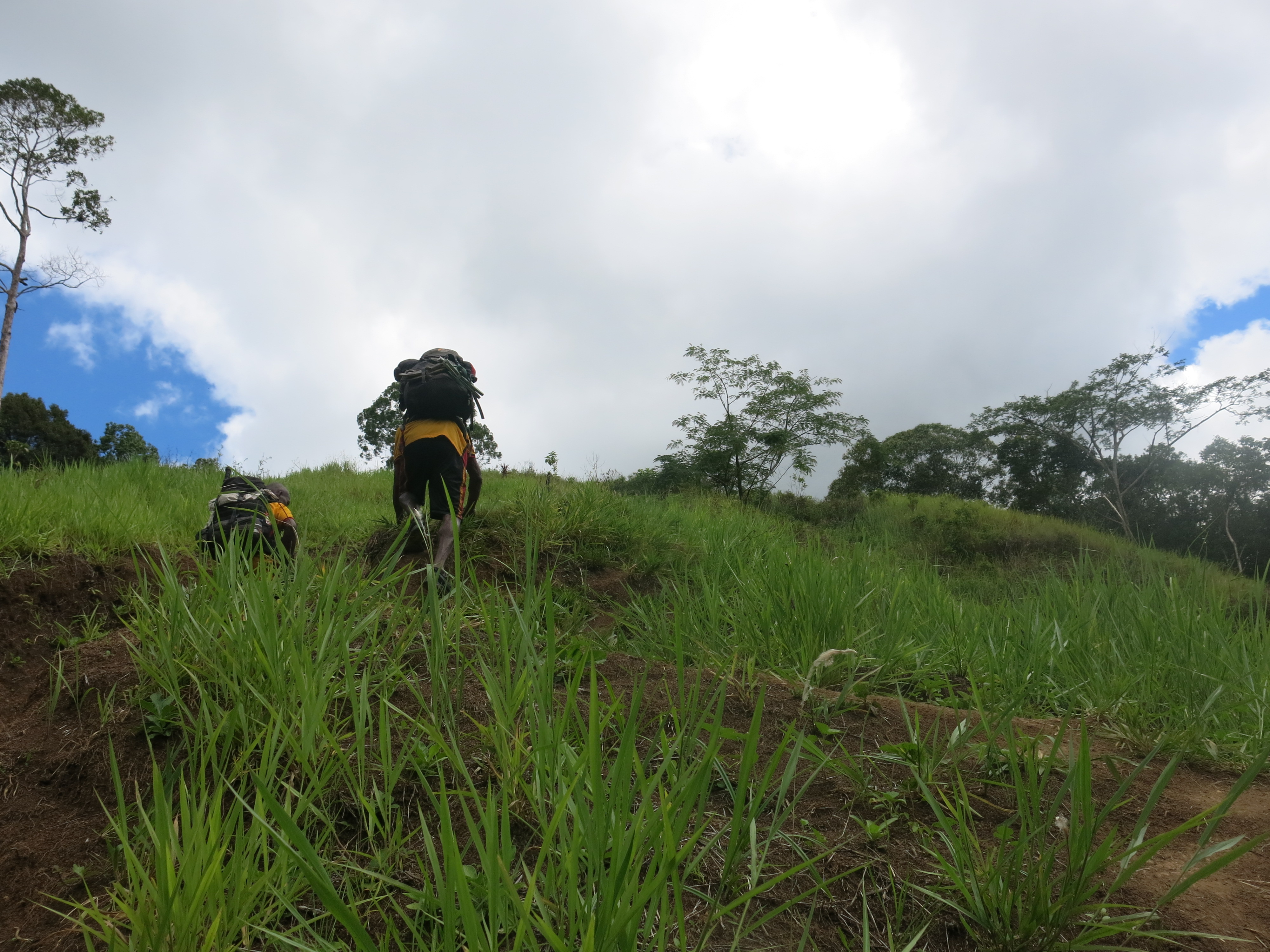
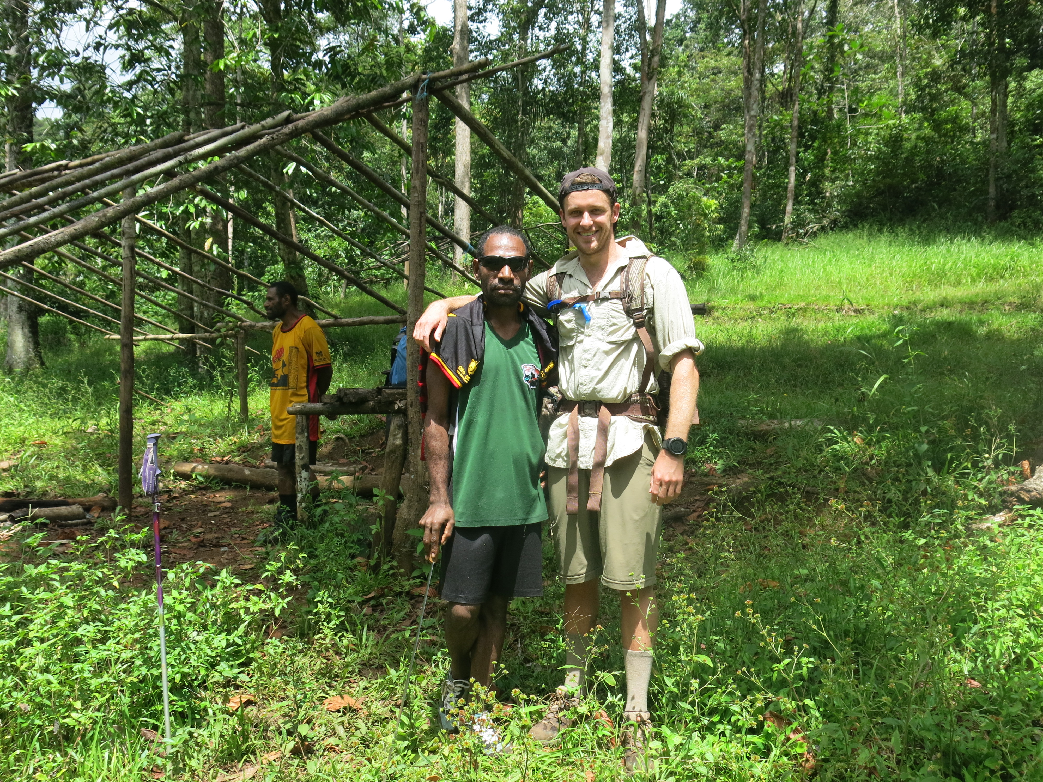
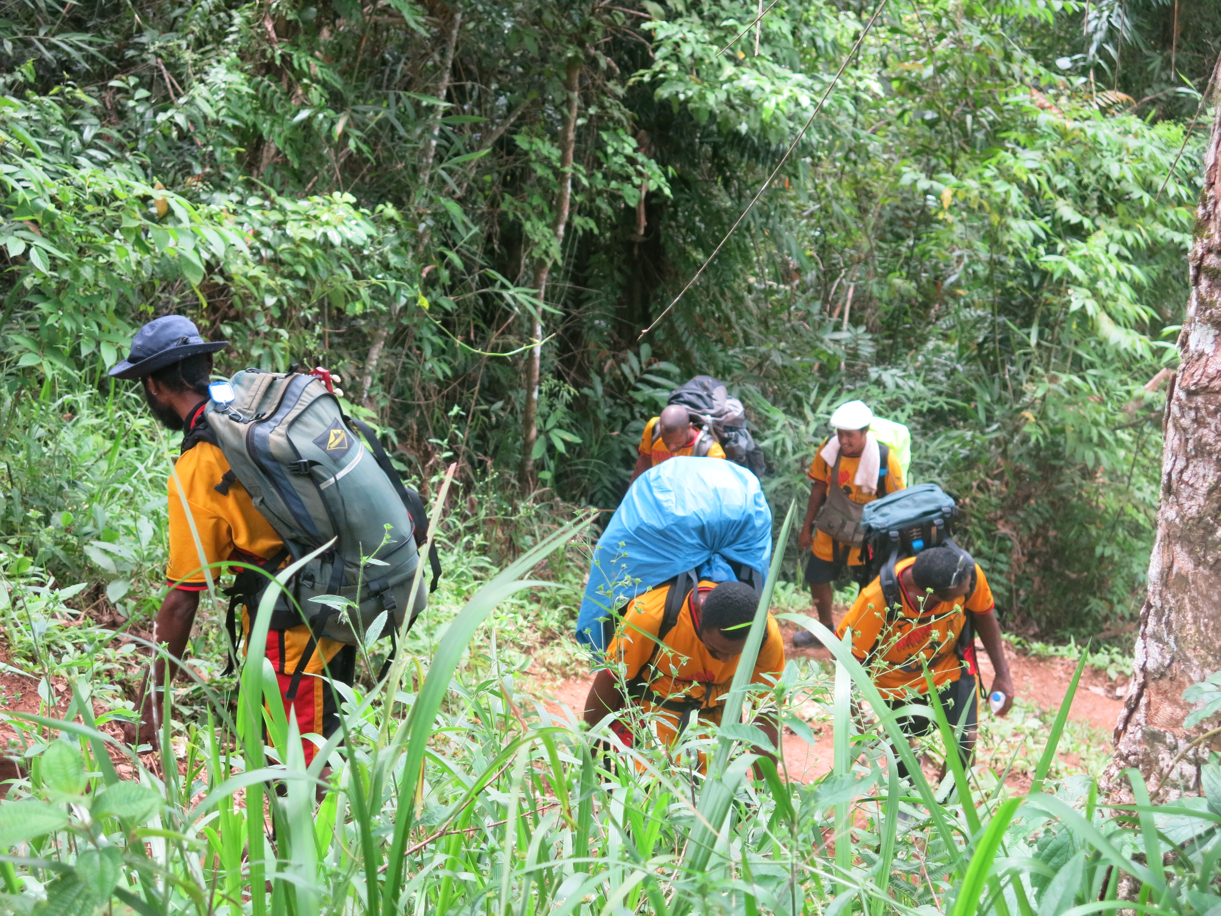
Upon the meeting of my personal porter (due to a neck injury last year), the porter lifted my pack and laid an egg. The bag was much heavier than the porter had anticipated and for this he was not thankful. The poor bloke’s back would have been like mine by the end of the six days. The porter will have to sub-contract his porter duties to someone else after this trek. (‘The porter’ did have a name however I have chosen not to use it in this post as to not single him out specifically).
Everything the porter had to carry, I brought, except one thing. The stench. That horrid, thick, odour from a man who had trekked the Track 106 times in his life, many a time, including this one, back to back.
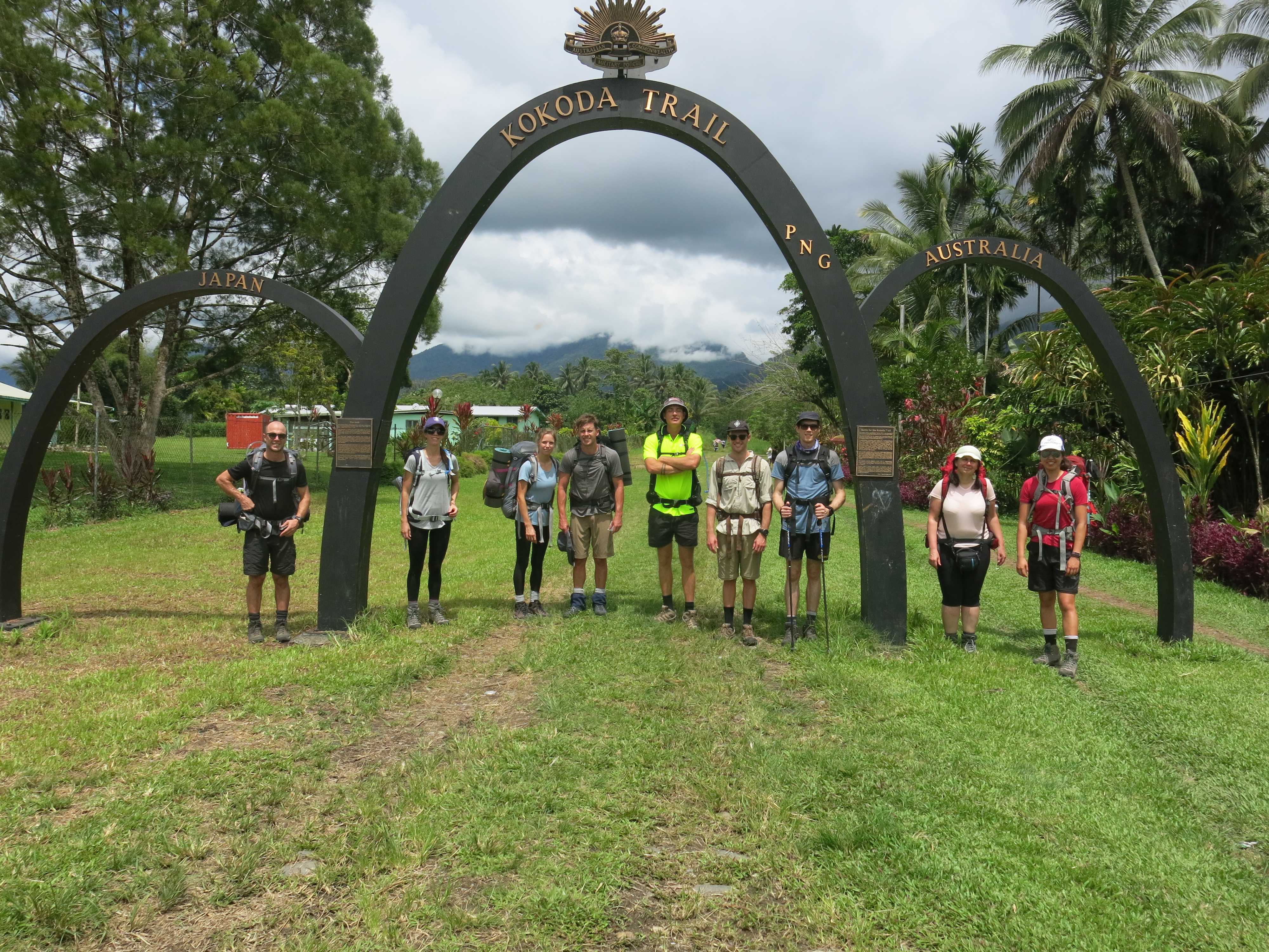
From left to right: Paul, Kathryn, Karly, Guy, Ben, Nathan, David, Monika, Rose
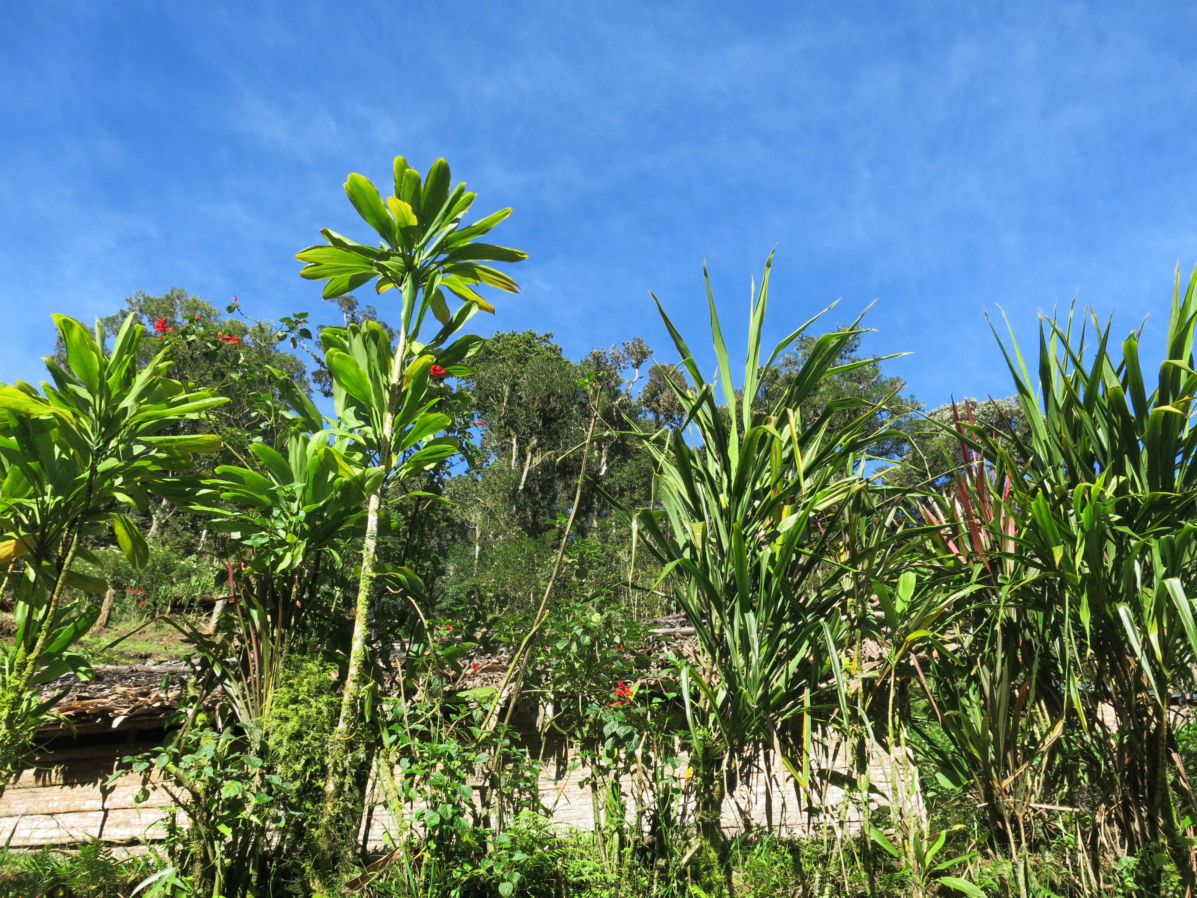
Isurava Village was the first stop for the night after only half a day trekking. The first night was had in a little hut built buy the locals.
Day 2
Summary:
- Distance = 25km
- Time = 9:18hrs
- Ascent = 1285m
- Descent = 902m
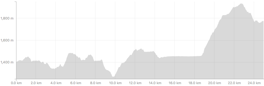
The day started at 4.30am with a bit of strategy. The pit toilets are much more tolerable at this time as: 1) nobody has used them for some hours, 2) the sun hasn’t heated up the pit.
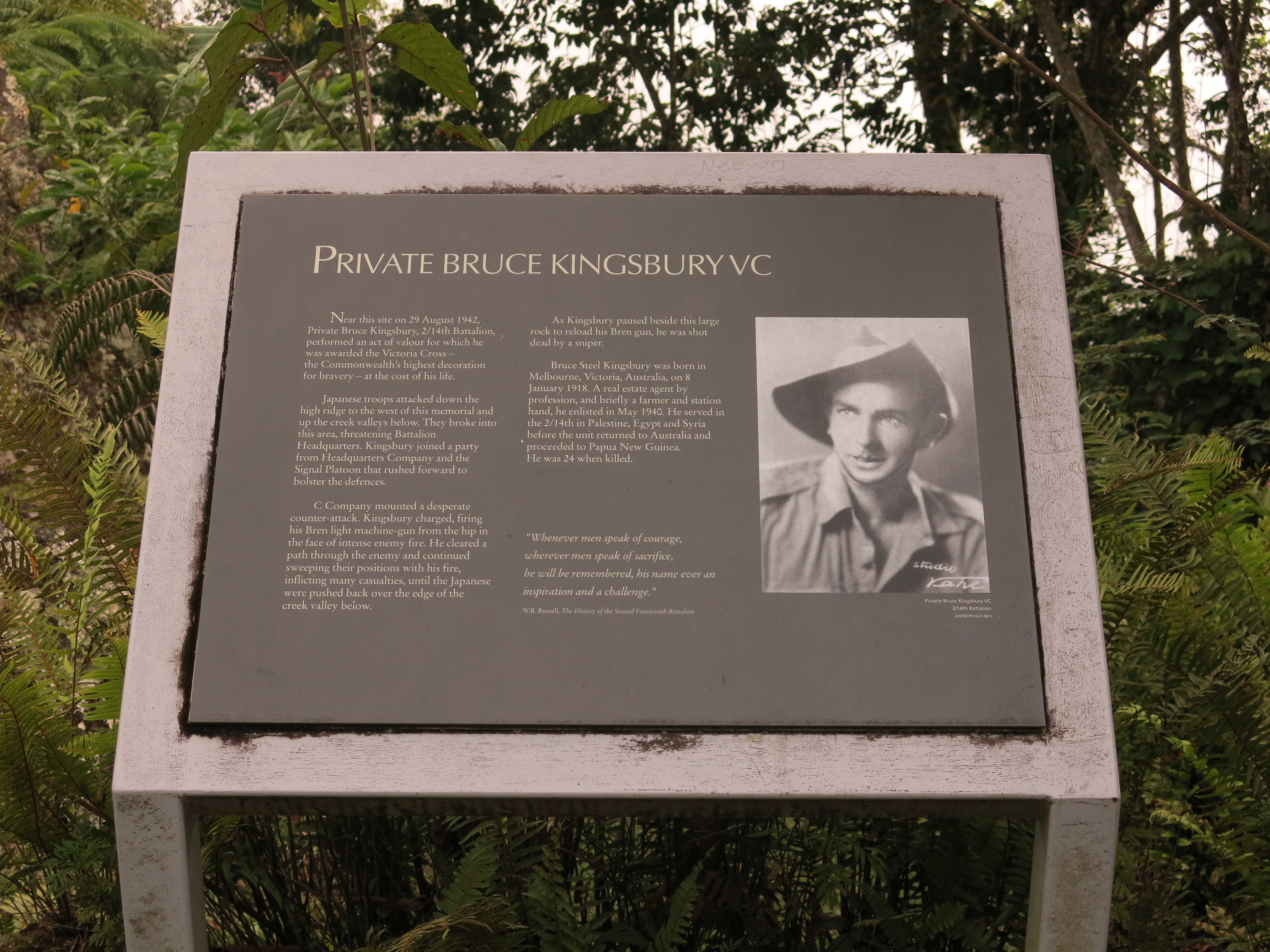
Walking through the Isurava Memorial was a tear-jerker. It was one of the many lines of defence the Aussies held to prevent the Japanese from heading further south toward Port Morseby. The 39th Battalion held off 10,000 Japanese troops for days until the Australian Imperial Force (AIF) could get there as they had to hike the Track to Isurava.
For those who may not know, the 39th Battalion (or ‘The 39th’ as I’ll refer to them as), were a bunch of Aussie battler troops that were banded together as a back up defence for Australia, having minimal training but a bit of agro in them.
The 39th held off the Japanese for 4 days and nights before being ordered to stand down once the AIF arrived. The AIF were losing the battle so without instruction, the weary 39th stepped back in to fight alongside their comrades. It should be noted that the AIF didn’t think highly of the 39th and so neither did the 39th of the AIF. But the 39th stood up anyway to protect both their fellow Aussies and their mates they fought alongside.
There were many sacrifices made at the Battle of Isurava, but one that struck particularly, was Private Bruce Kingsbury VC, of whom, with his machine gun in hand, charged toward the Japanese troops to give his Aussie comrades a greater chance to win this battle… and they did. Private Kingsbury was shot by enemy sniper perched up on the Ranges. He was a 24 year old real estate professional. I can easily say that I will never have as much courage as this man.
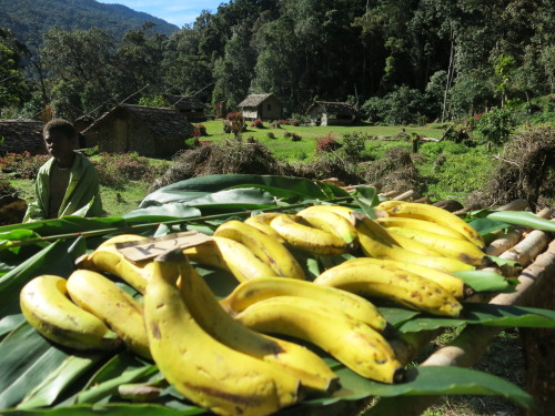
As we were leaving the Memorial site to continue with the trek, one of the blokes in our trekking group, Ben, decided to buy a banana from a local kid. Upon approach to the bananas, he had all the cash he brought on the trip in hand, the first of his mistakes.
Ben asked the, maybe 10 year old, kid how much for one banana. We all heard the child said “7 Kina” but Ben heard differently.
Happily peeling back the skin of the banana with a spring in his step back to the group, we asked how much he haggled down to. Ben said he paid 70 Kina for the banana. That’s about $30 Australian dollars. Ben paid 30 bucks for one single banana. This is why his fiancé is in charge of their finances.
The kid who sold him the banana absolutely could not believe that he will be able to retire in the next few if he gets a few more morons buying bananas at that price. To put this in comparison, at the next village over, I paid 2 Kina for 2 bananas and I still probably got ripped off.
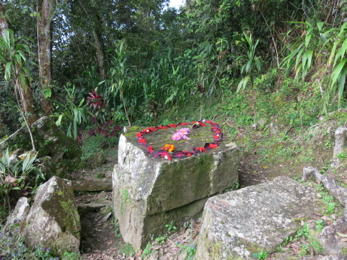
As we continued to hike, we saw the medical rock. Our boys with only the most serious of injuries, were carried by the Fuzzy Wuzzy Angels to the medical rock. This rock was completely flat and used as an operating table. It would take 8 Angels to carry one soldier so many Diggers in need of assistance has to make their own struggle there.
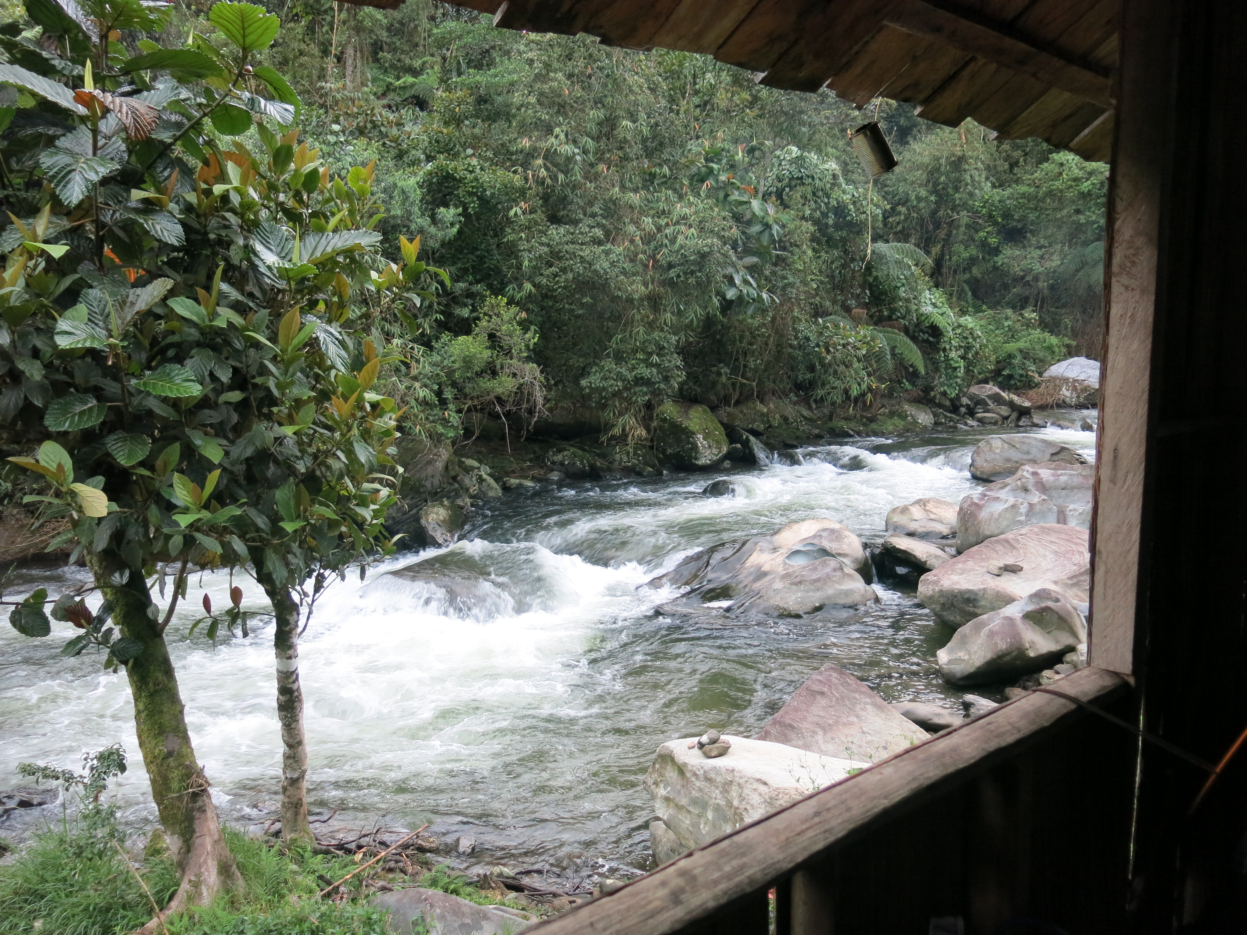
Through Eora Creek to Templeton’s Crossing (Templeton’s 2) where we stayed the night by the river in a little hut. To be able to submerge and wash off the sweat was heavenly.
Day 3
Summary:
- Distance = 19.09km
- Time = 7:53hrs
- Ascent = 968m
- Descent = 1136m
As we are doing the fast trek, we got a wriggle on from Templeton’s 2 and hiked to our lunch spot at ‘1900’, aptly named after the amount of metres it lay above sea level.
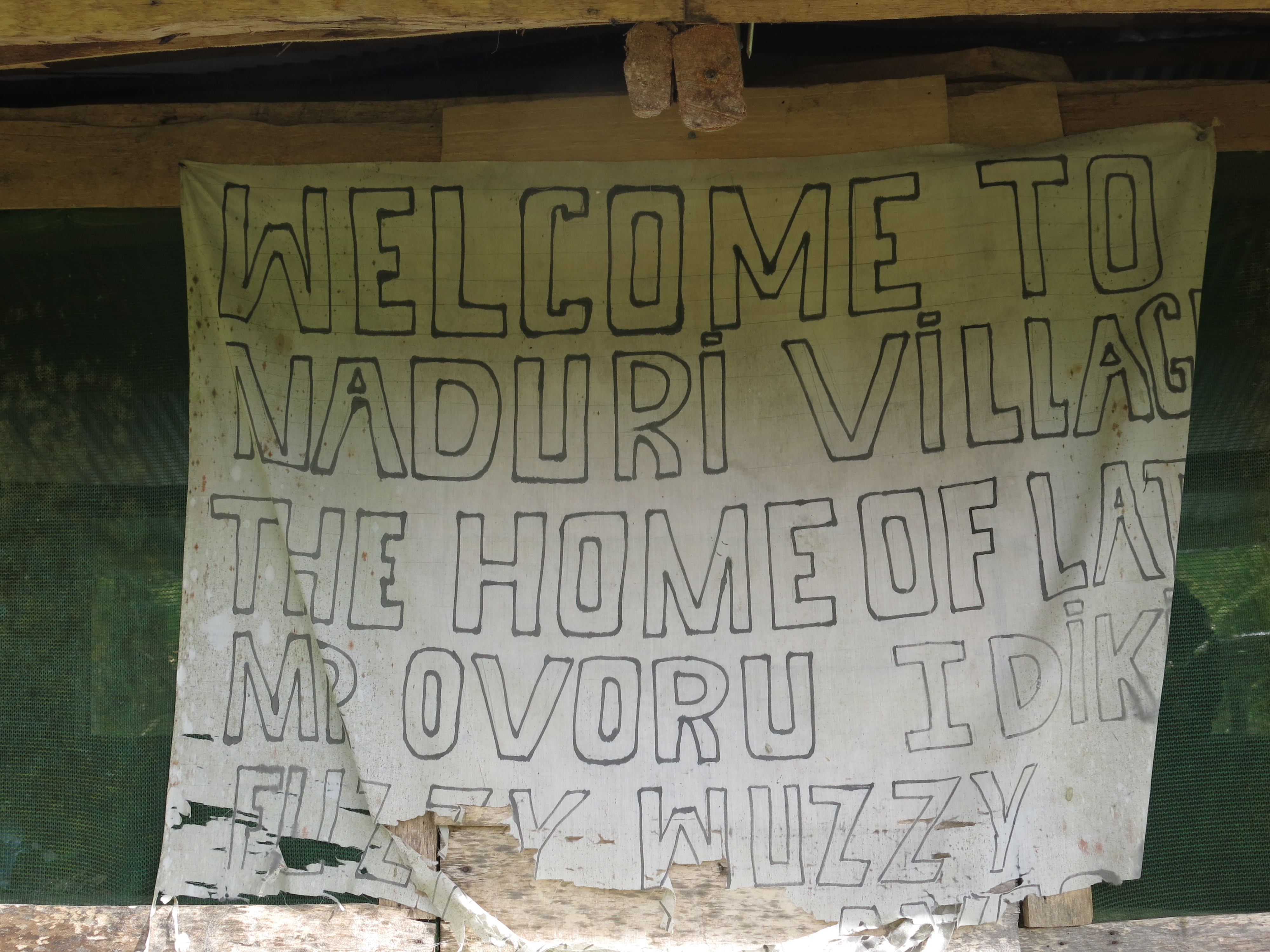
We smashed it out to stay on track, literally, and our afternoon tea break at Naduri Village, turned into an overnight stay as the downhill played havoc with Kathryn’s knees (the fiancé who is now in control of all the finances).
The land of Naduri Village is owned by the son of one of the last remaining Fuzzy Wuzzy Angels. Unfortunately, we were not able to meet the son and sadly the Angel passed a year or two ago.
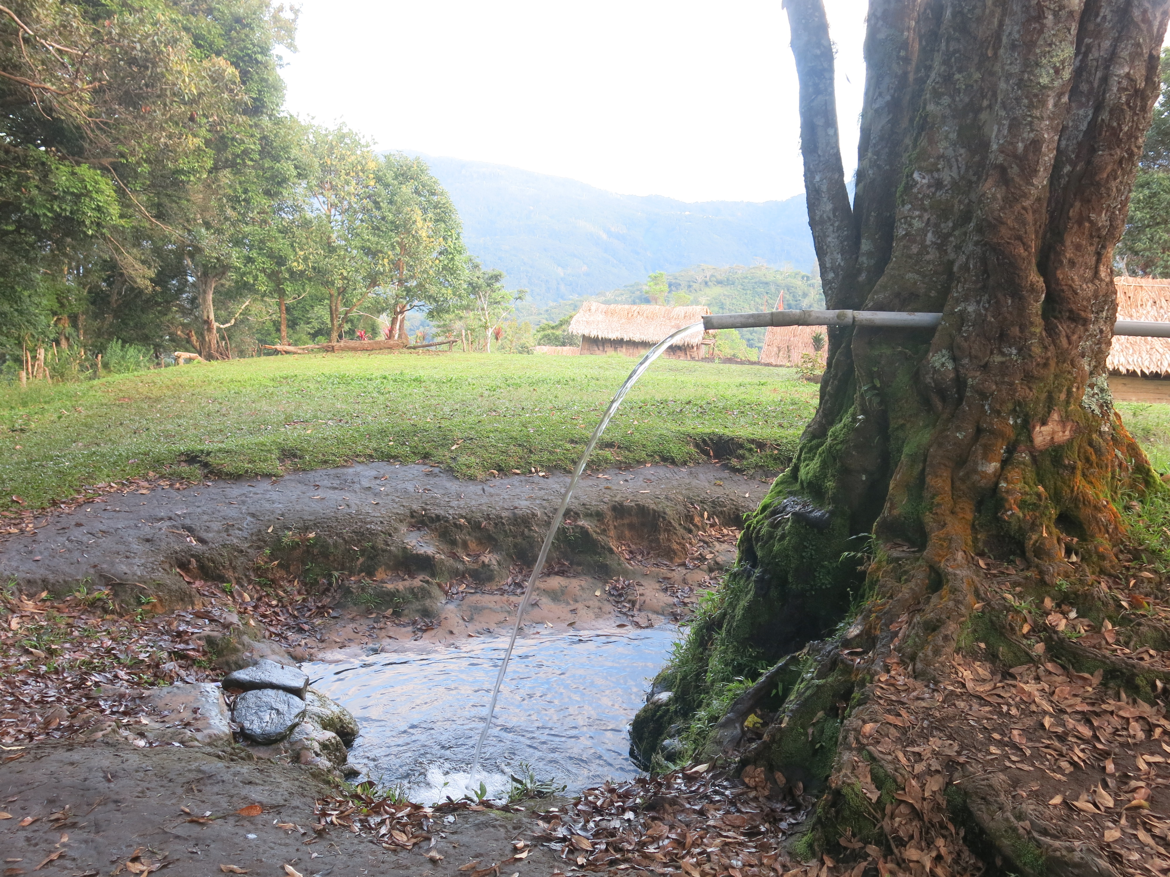
Showers at each campsite were either in the nearby freezing cold river or through a pipe that violently spat out freezing cold mountain water. Perfect after a day’s hike, perhaps not so much in winter.
Unpacking my bag to set myself up in another hut, I realised the porter stench had dissipated. It took me longer to realise that the only reason the smell was gone is because this is now what I smelt like and I was used to it. Unfortunately, smelling like a porter did not give me any special or increased ability to navigate the Ranges. I wish it had because those guys are crazy talented.
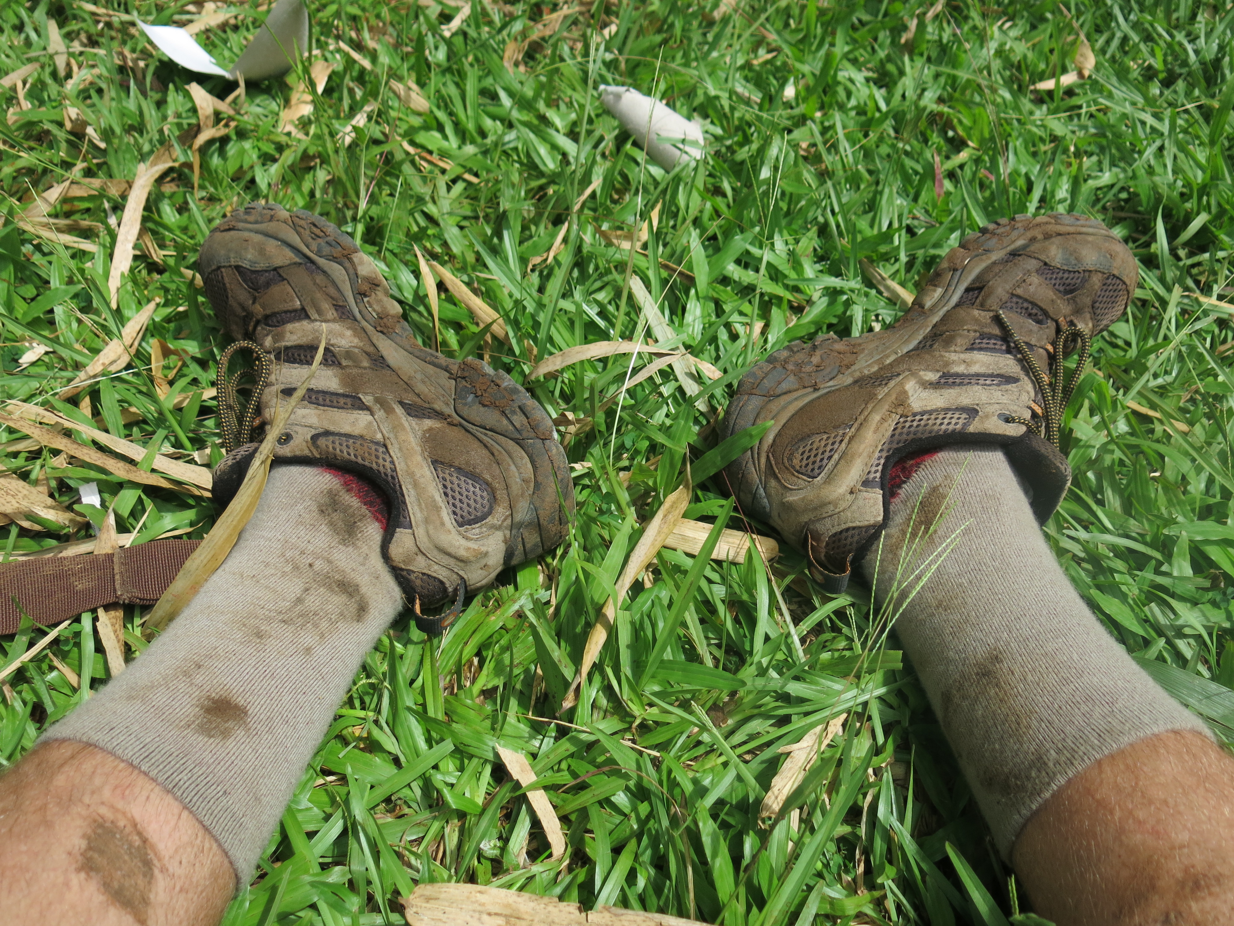
Today was the first day I worked up a blister too. I was lucky throughout the trip so far not to get any especially considering my boots were new. Surely wearing them the day before the hike whilst laying on my bed reading a book about Kokoda counts as wearing them in, right?
Day 4
Summary:
- Distance = 22.47km
- Time = 9:52hrs
- Ascent = 1190m
- Descent = 1944m
Our pre-intended campsite stop meant we had time to make up for yesterday.
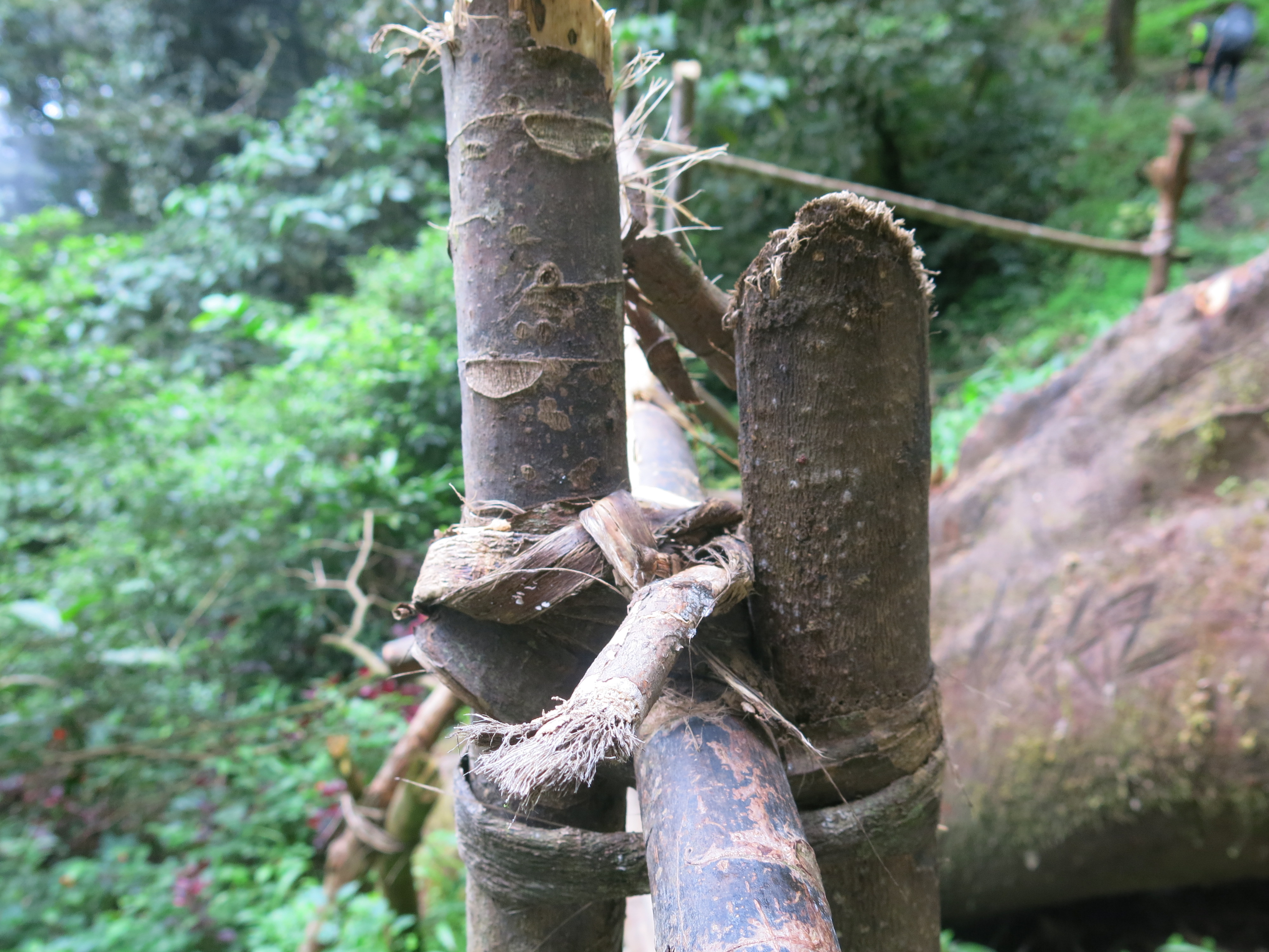
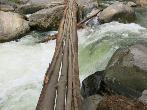
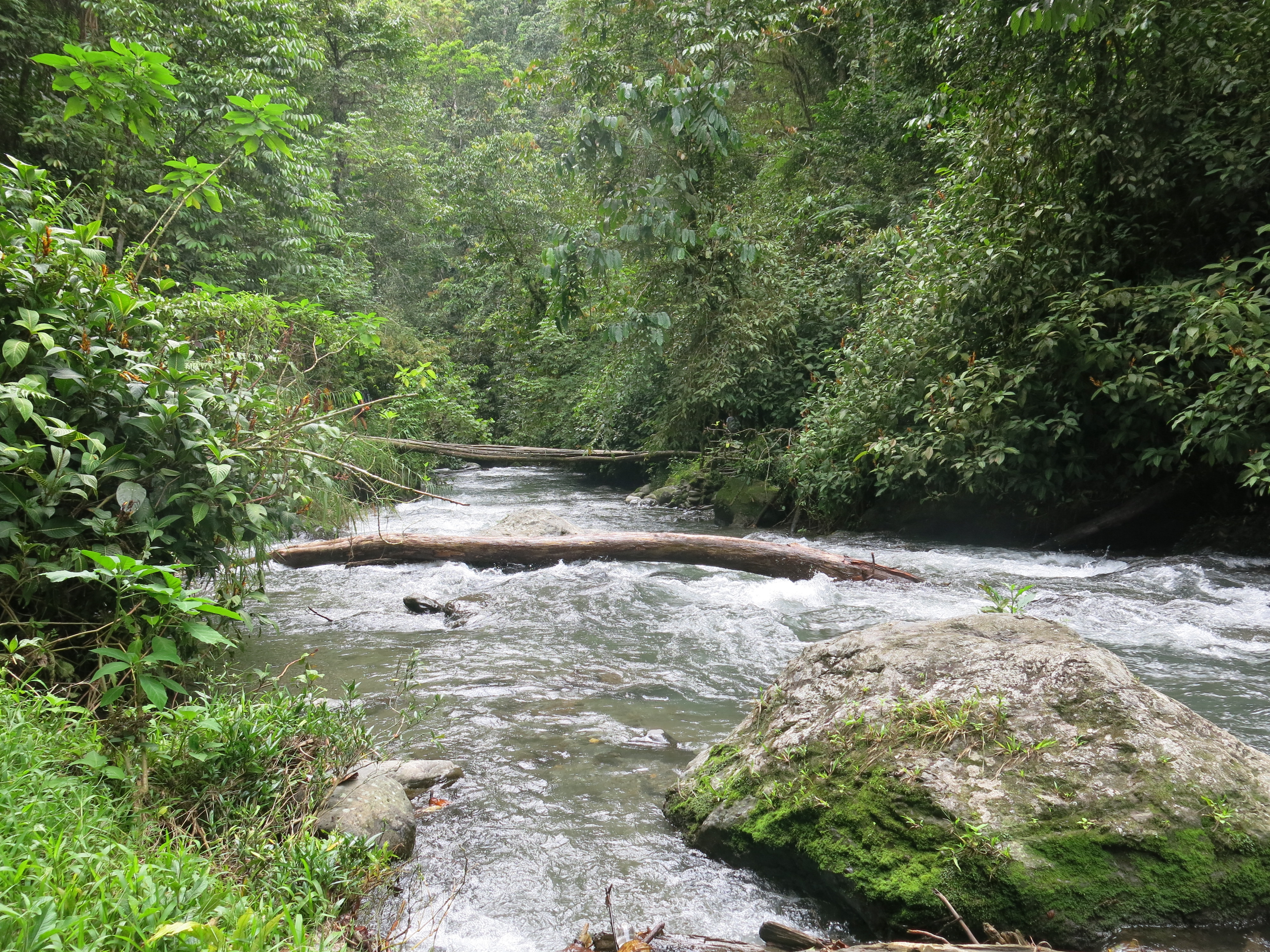
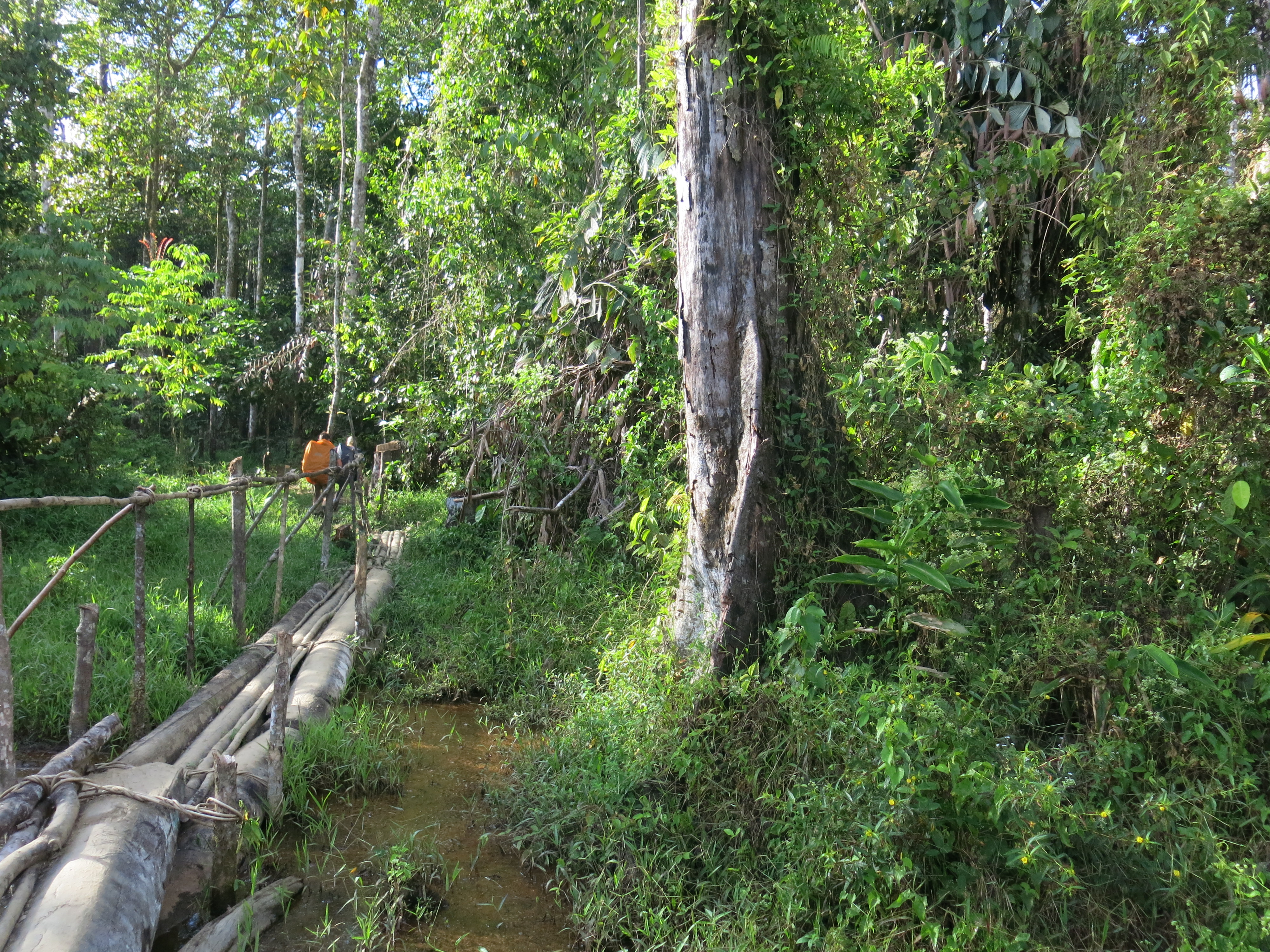
To call any of these bits of timber strung together by a bit of vine, a bridge, is a bit of stretch but here we are. And there we were. About to cross another bridge across another torrent of water. I followed Banana Ben onto the bridge and after all but half a dozen steps I heard a crack and within seconds had a log in between my legs, my backpack being the saving grace from it doing any damage or hitting my banana. At once, I had two porters holding onto my arms so I wouldn’t fall as I slowly dismounted the log between my legs. Banana Ben has snapped the log which is why it shot up toward my scrotum. As I safely passed, it then became a game of ‘how many PNG locals does it take to fix a bridge?’ I counted nine, yelling at each other in Papuan.
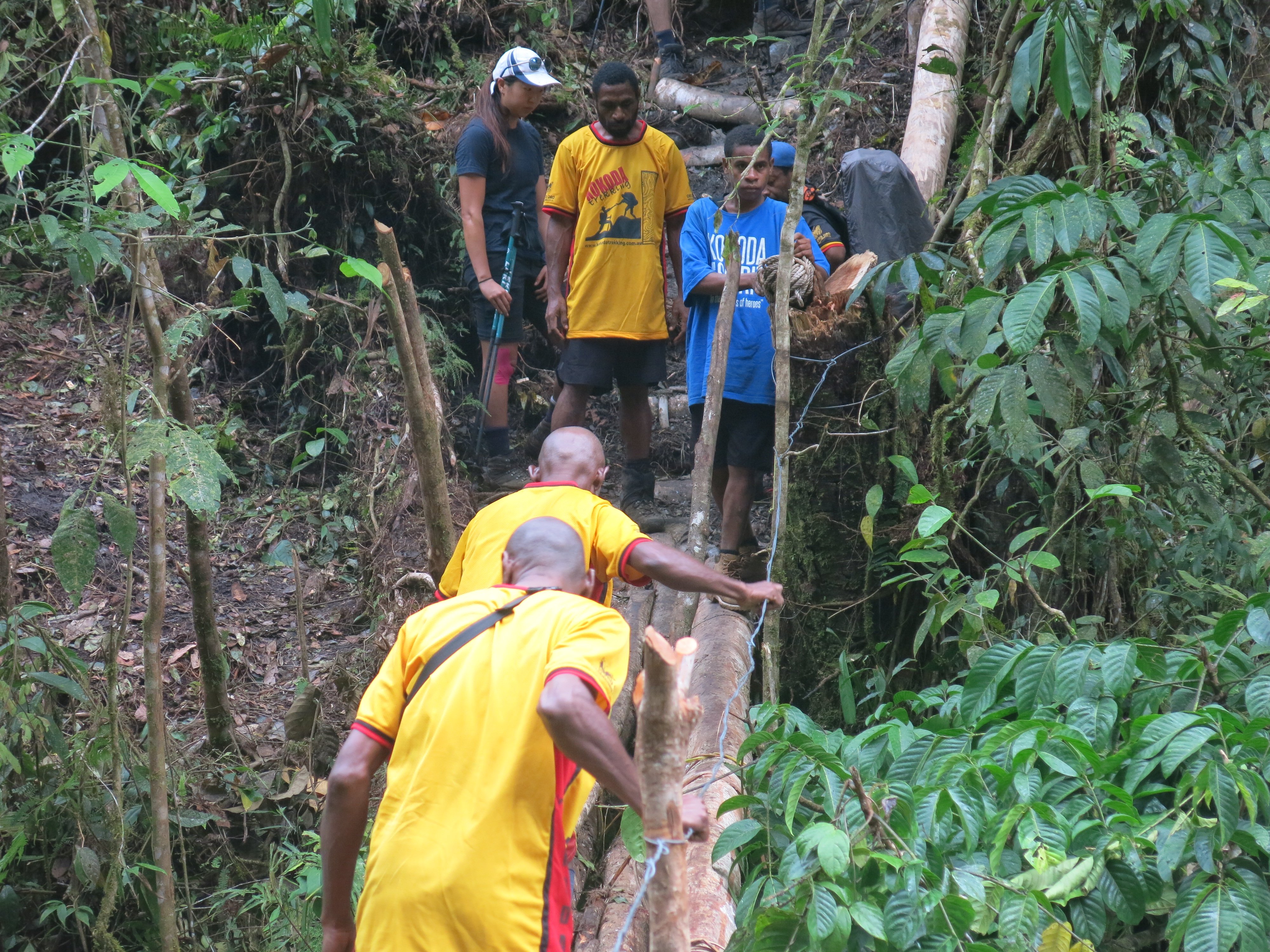
The climb from the bridge had a 70 degree gradient according to my watch. It would have been pretty on the money too. This thing felt vertical.
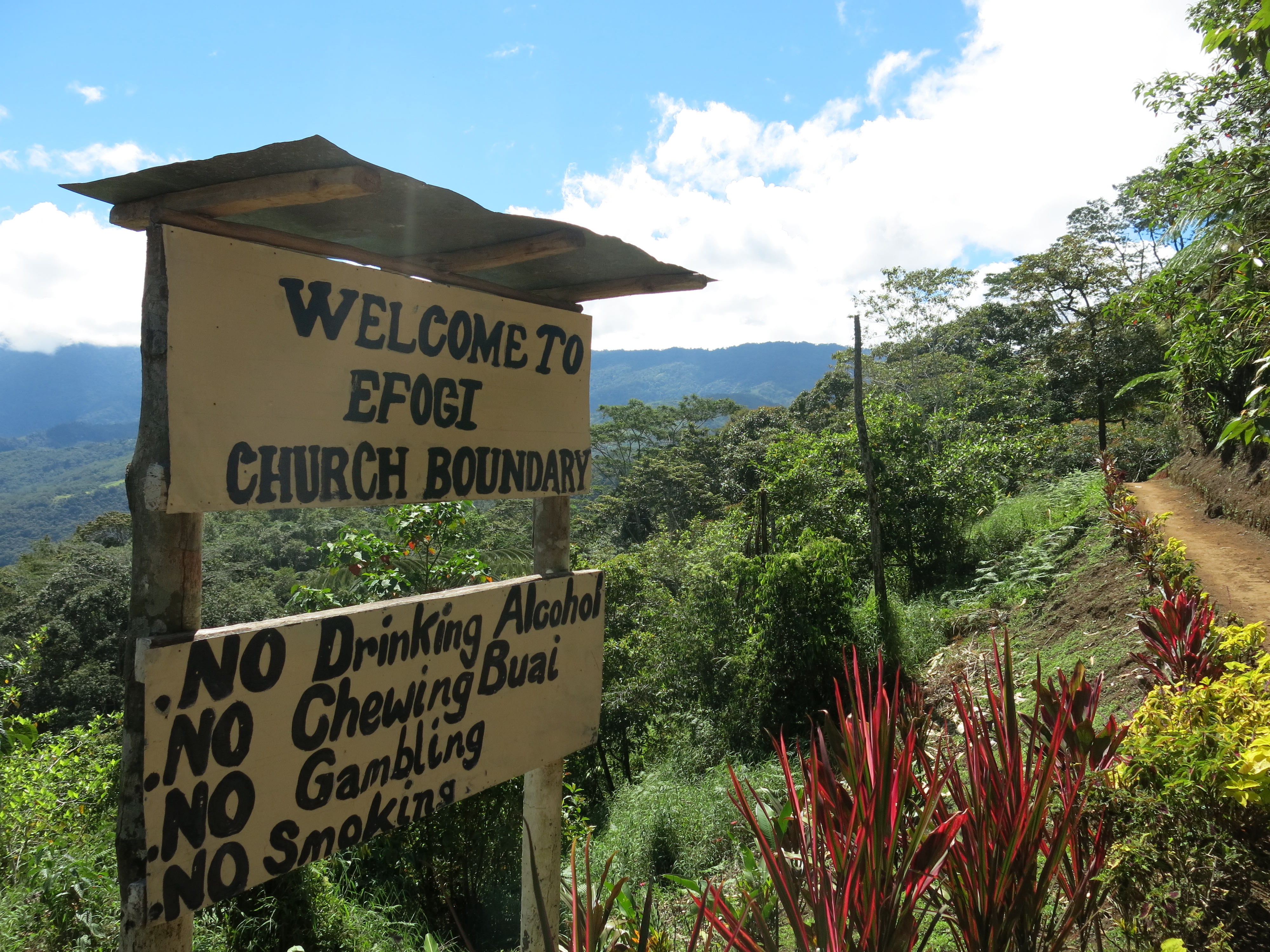
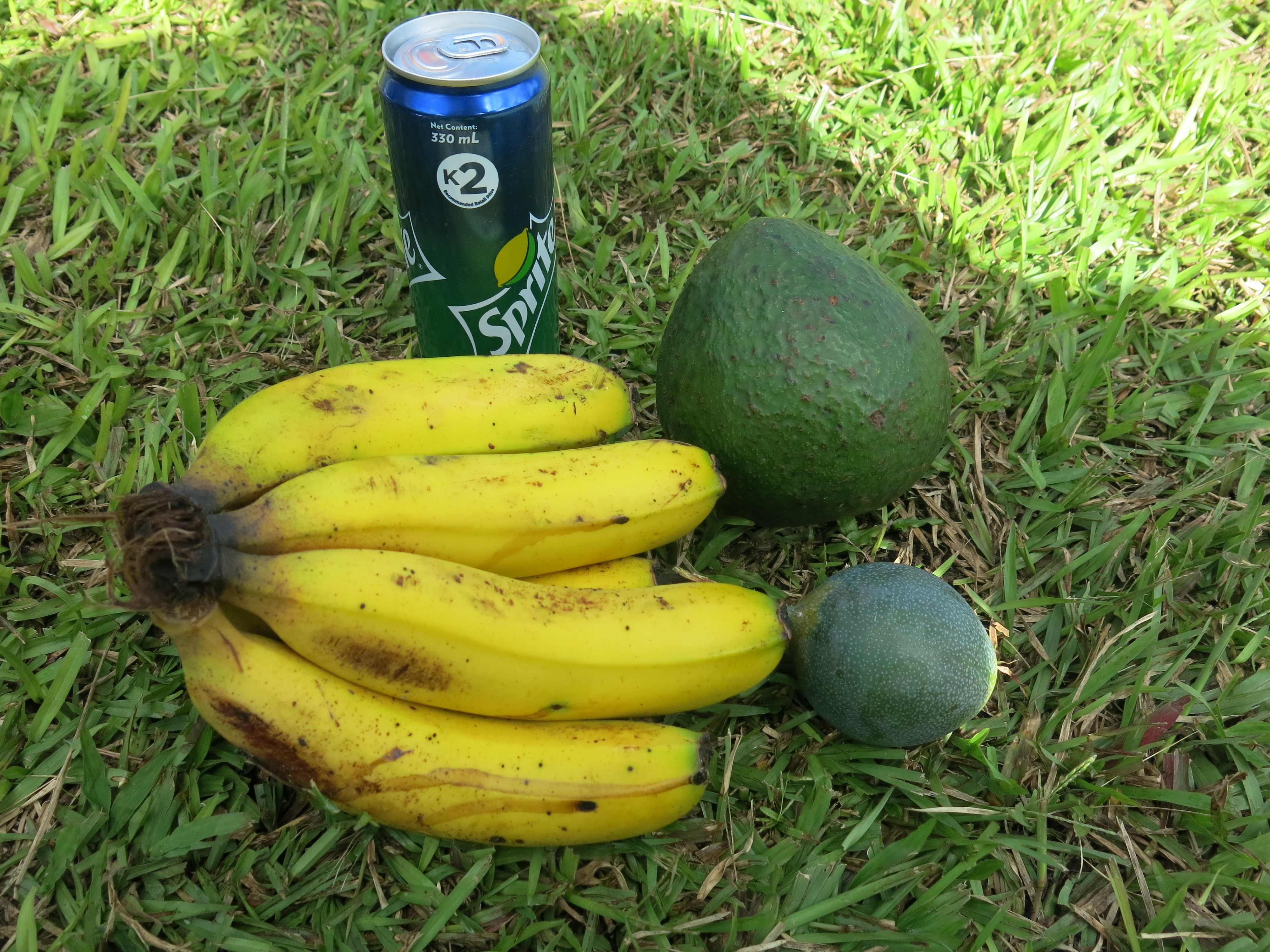
A quick stop at Efogi village, where we were scheduled to camp last night. There were more locals selling fruits including the biggest avocado I have ever seen in my life. I thought it was a coconut at first.

Lunch at Brigade Hill, another spot where the troops fought off the Japanese attack. The sun started to feel hotter and hotter and from this point, although no rain so far, my shirt, shorts and undies were drenched in sweat.
Camped in Shrek’s swamp i.e. Agulogo. Malaria infested mozzies buzzing around everywhere. Never slapped my body so much trying to get them all. As I struggled to sleep in my sauna of a tent, it was one of those moments whereby I had more and more admiration for the Diggers and what they had to put up with.
Today was one of the most difficult days of the trek.
Day 5
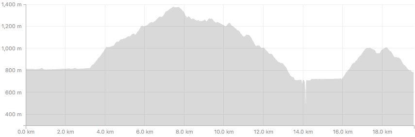
Summary:
- Distance = 19.61km
- Time = 8:11hrs
- Ascent = 1486m
- Descent = 1639m
One of those day’s today where I was playing Russian roulette with my undies, except instead of bullets, I was armed with farts from semi-crook guts.
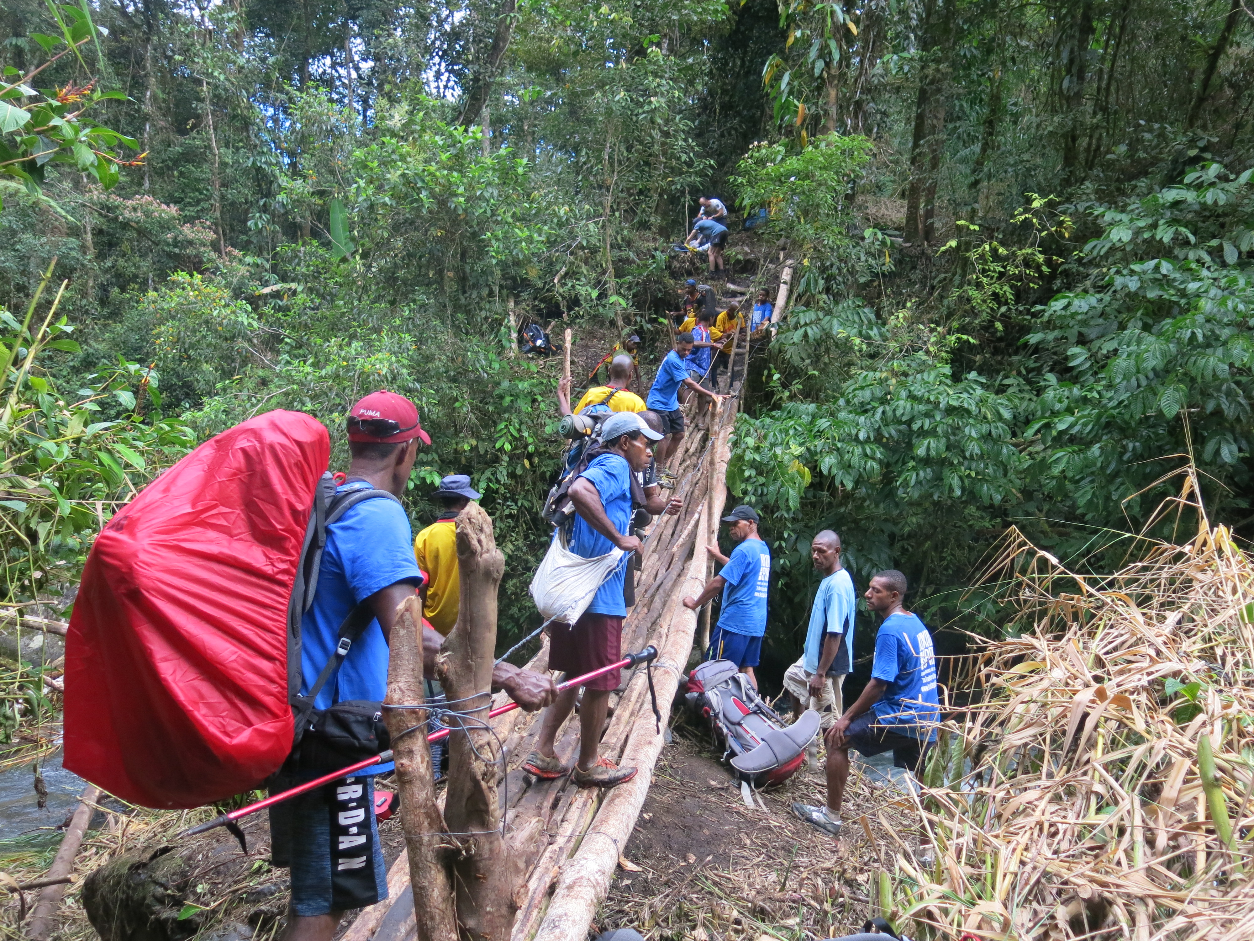
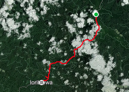
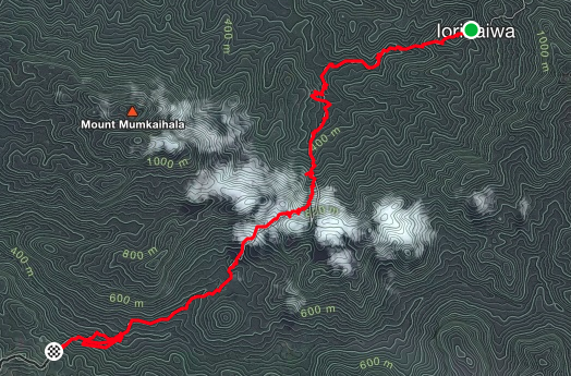
On our way to Ioribaiwa Village for the night, a river crossing with a fallen tree as a bridge for one half of the crossing and no bridge for the second part of the crossing lay before us.
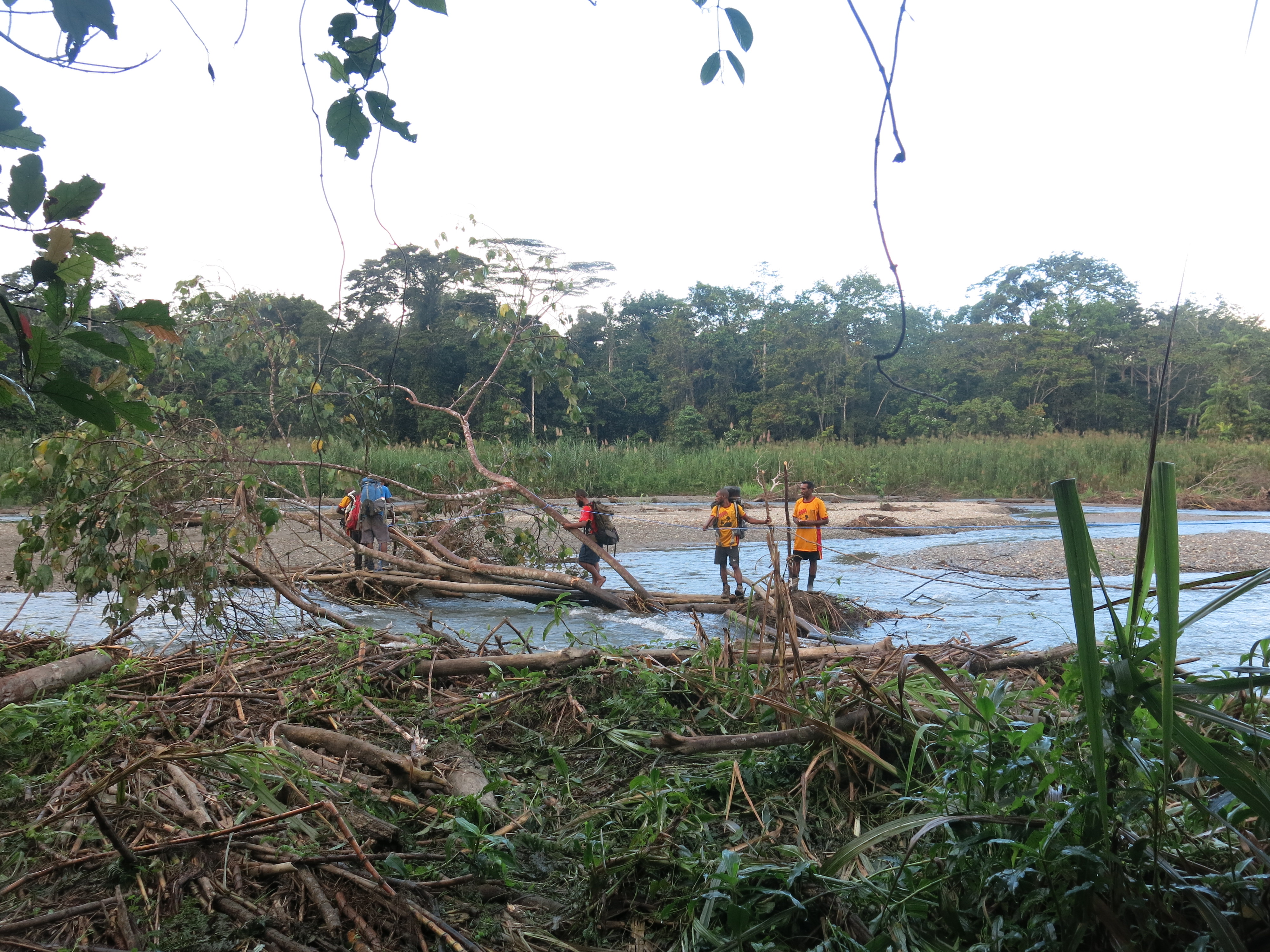
Upon approach, two of the porters had already crossed and sat on the bank singing and playing a ukulele.
As the temperature reached the high 30 degrees, it was the first time I was really exposed to the psychological exhaustion. All I wanted to do was finish the trek then and there. The heat, humidity and hills absolutely knocked me about. After 4 long day’s of trekking already, my energy levels were low despite the vitamins, hydrolite, protein bars, glucose tablets, etc I was consuming to replenish energy. It simply wasn’t enough. I snapped myself out of it when I remembered I was only there for days and not for months, with a foreign enemy trying to kill me, with no food, minimal shelter, and my mates next to me with their life on the line too. It shut me up and brought me back to earth pretty quickly.
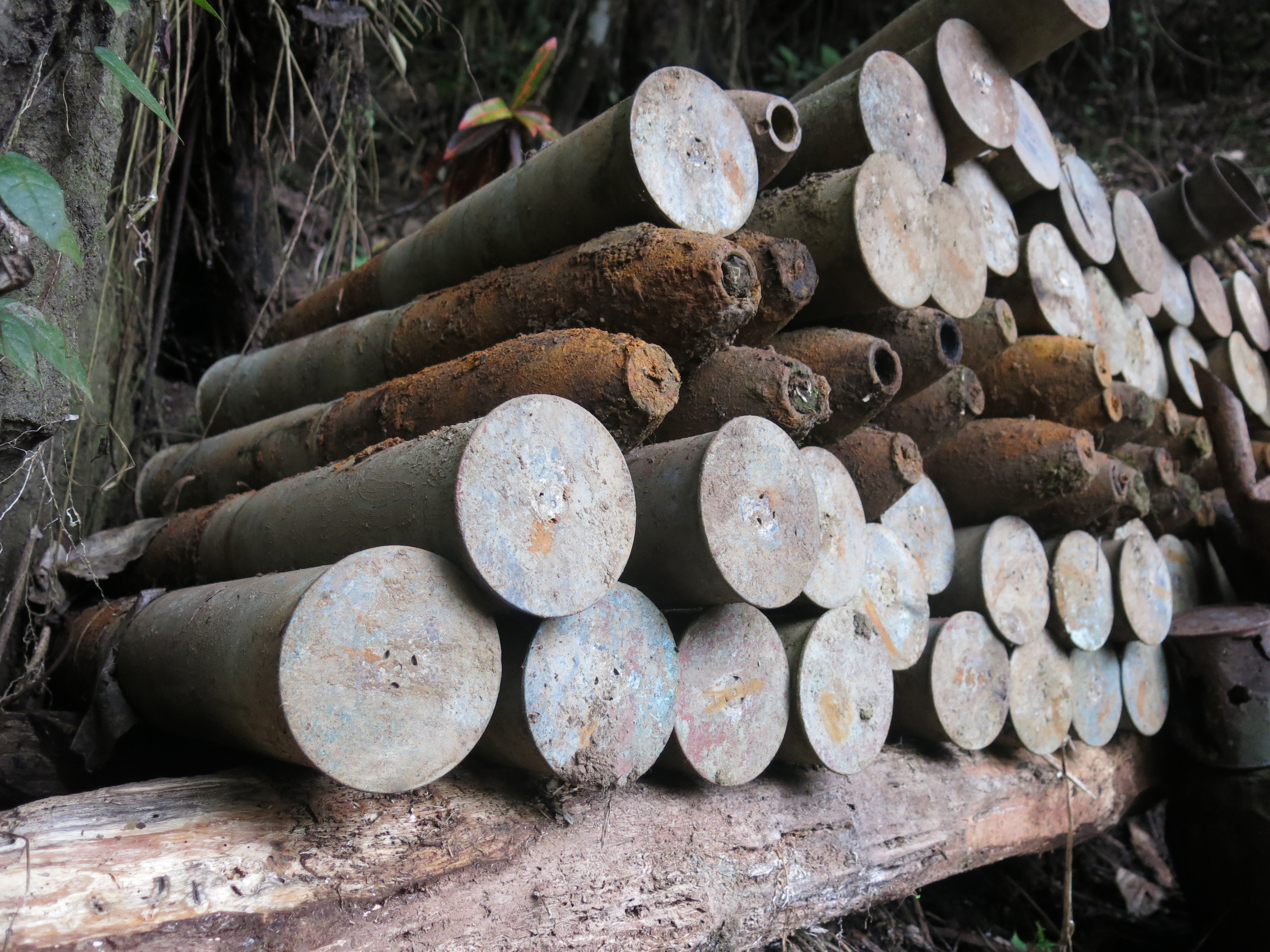
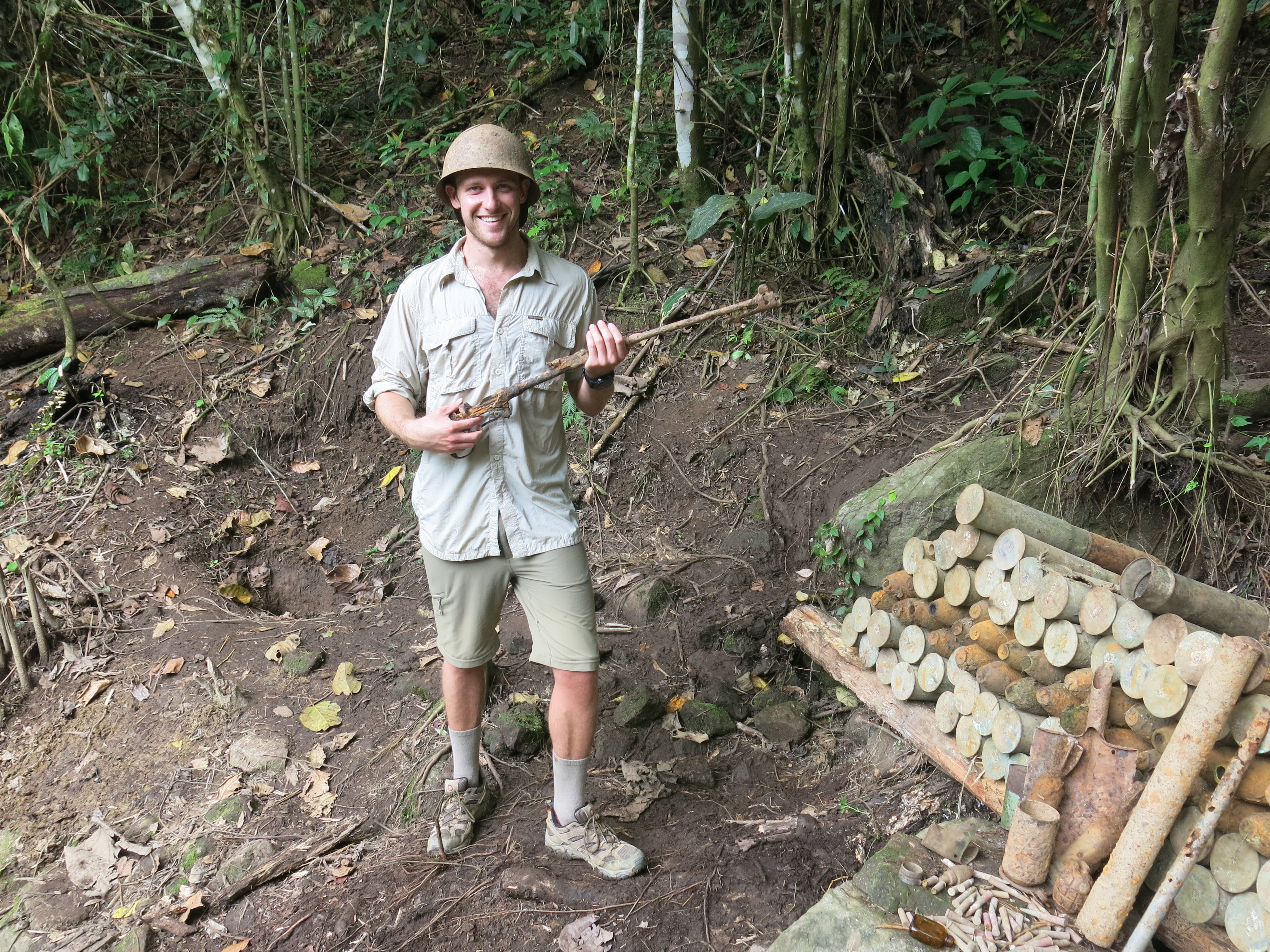
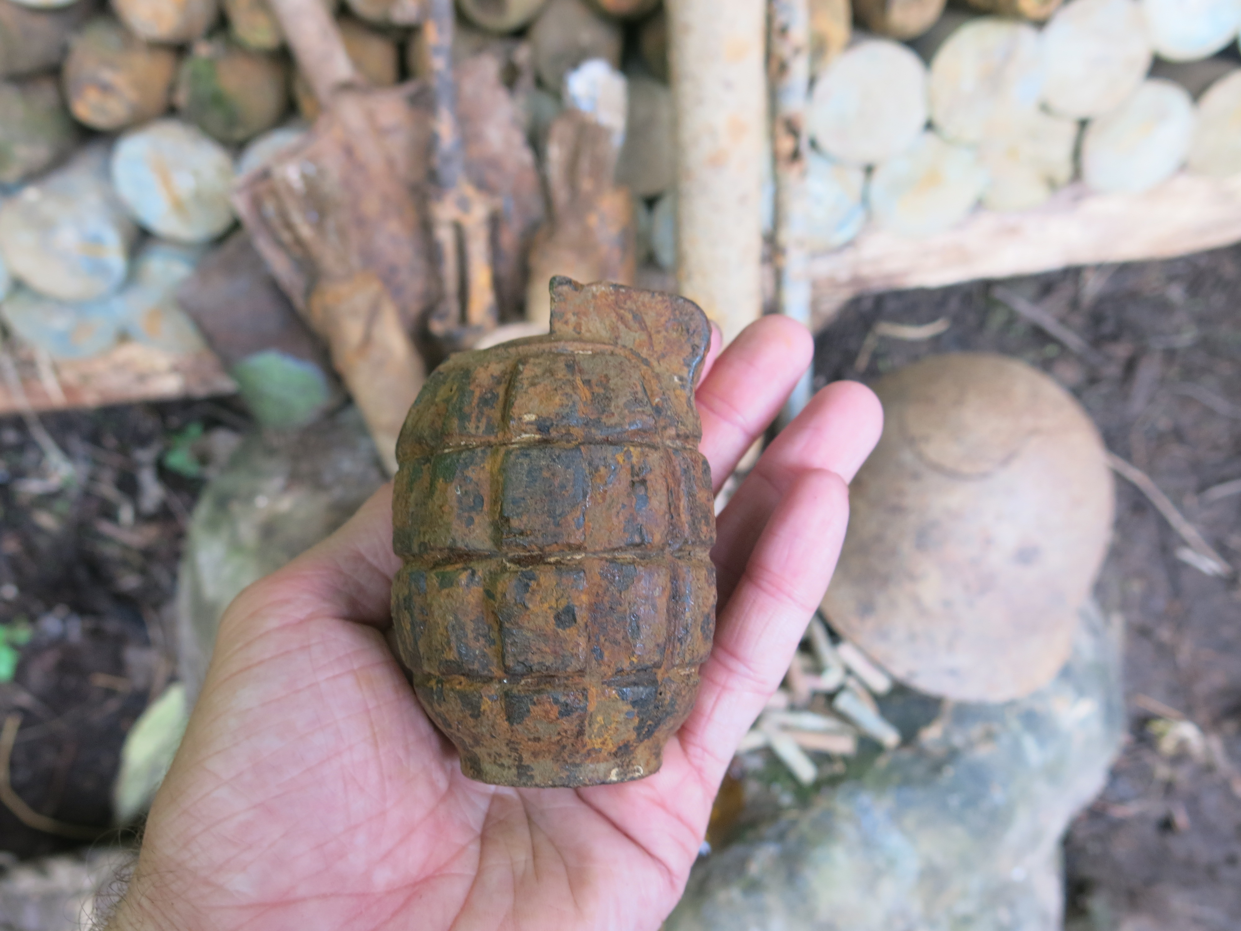
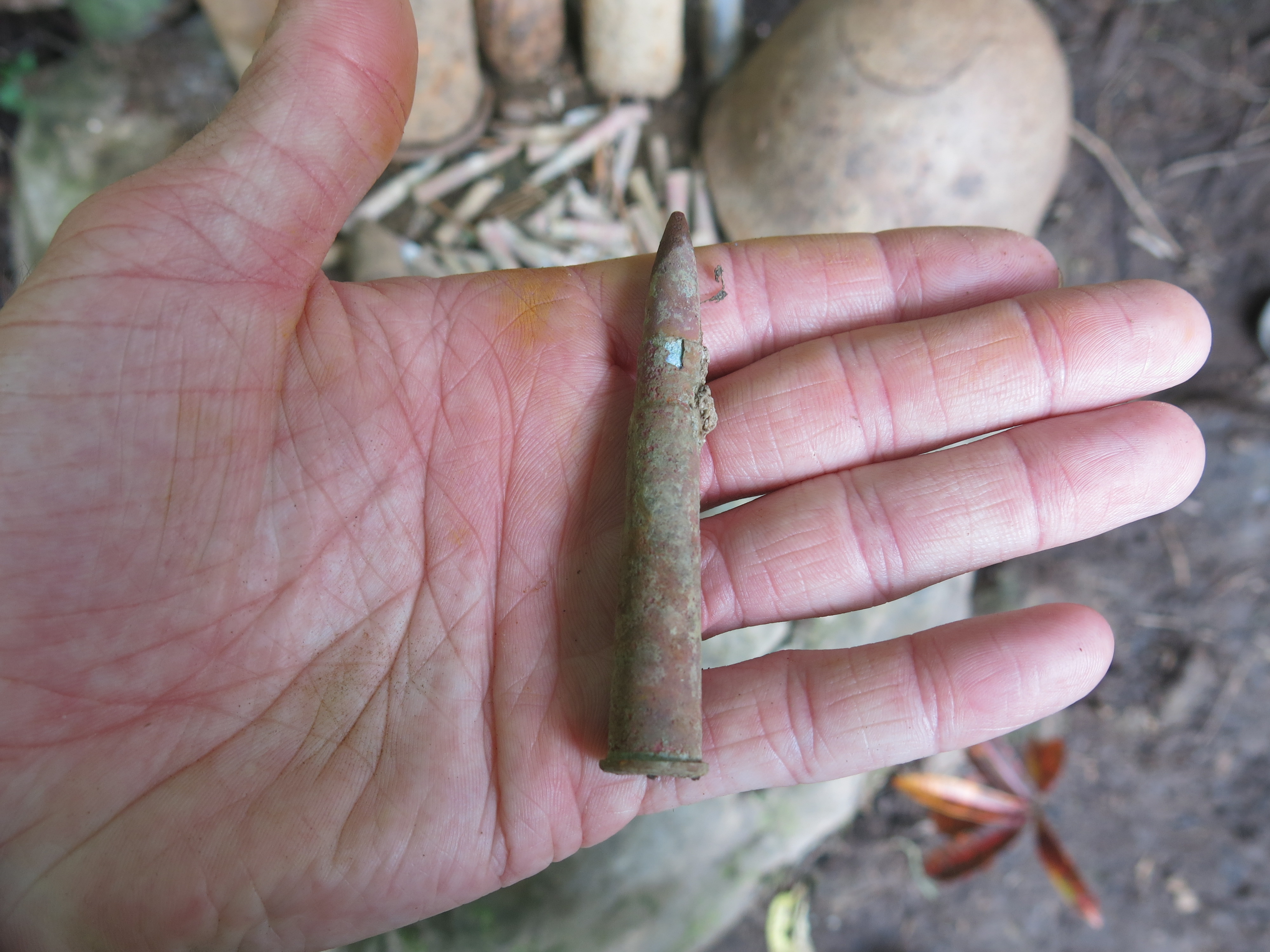
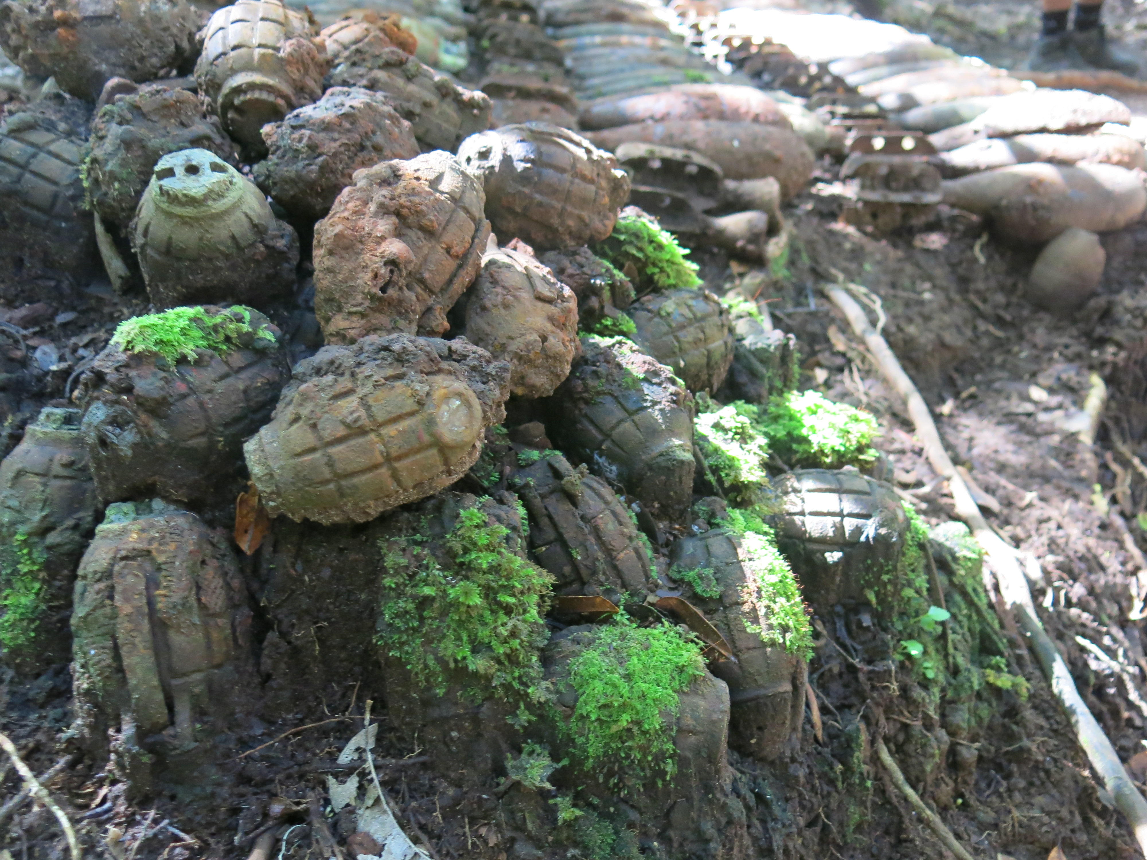
A Japanese ammunition site was at the top of the hill between Ofi Creek and Ioribaiwa Village. 10 Kina allowed a six minute walk off the Track to see weaponry the Japanese stashed in the hillside so the Diggers couldn’t get their hands on it. Apparently the locals only found it last year when they were searching for bananas. I’m calling bullshit but that’s their story. It made me wonder how many other undiscovered ammunition stashes there were buried on the rest of the track.
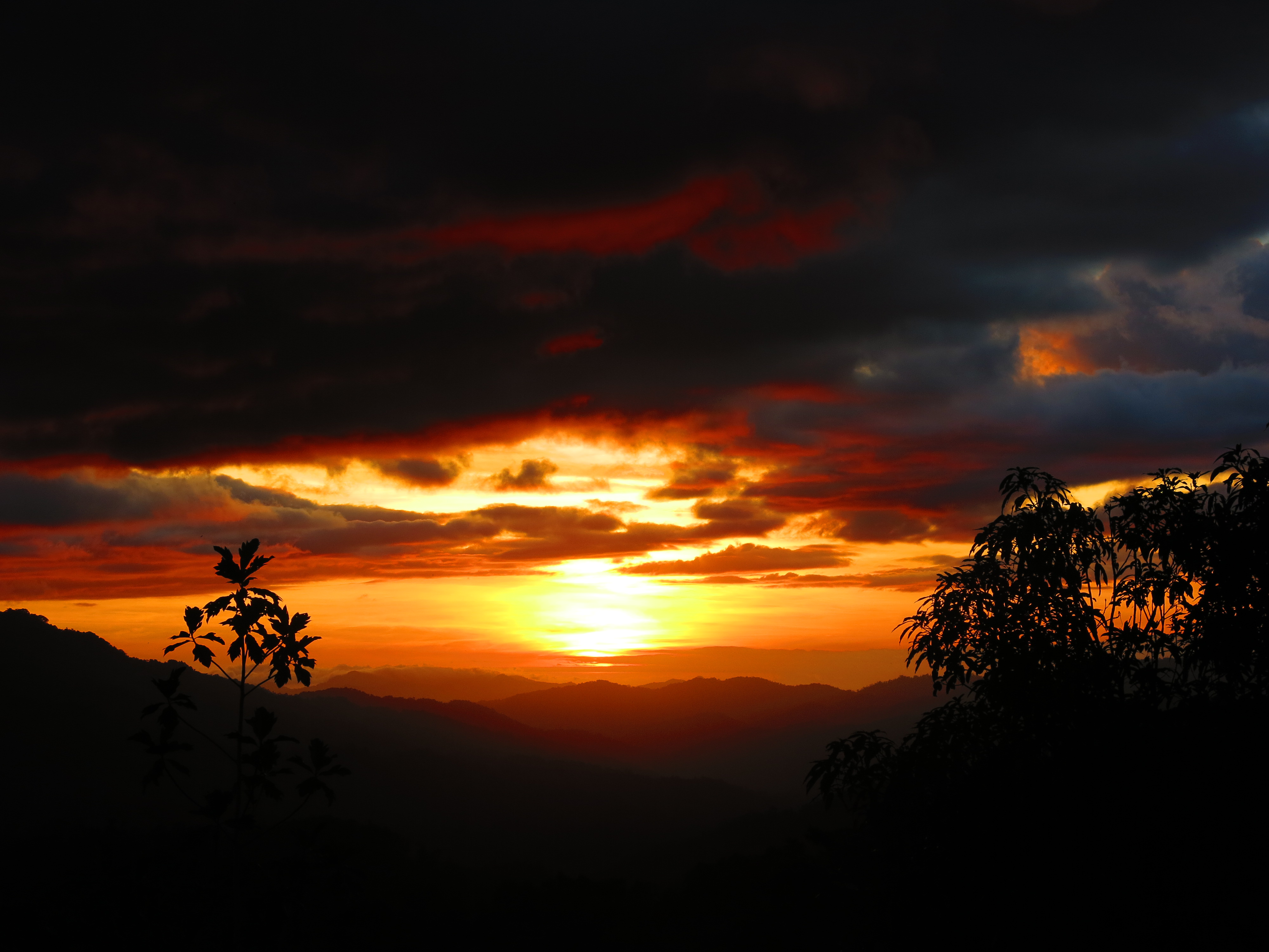
Ioribaiwa Village was the furthest south the Japanese reached to Port Moresby before silently retreating. Apparently they could see the lights of Moresby. All we could see was the sunset.
Day 6
Summary:
- Distance = 20.54km
- Time = 7:17hrs
- Ascent = 2940m
- Descent = 2971m
- (I think the ascent / descent numbers for today are a tad off as swimming in and jumping into Goldie River inflates the numbers a bit)
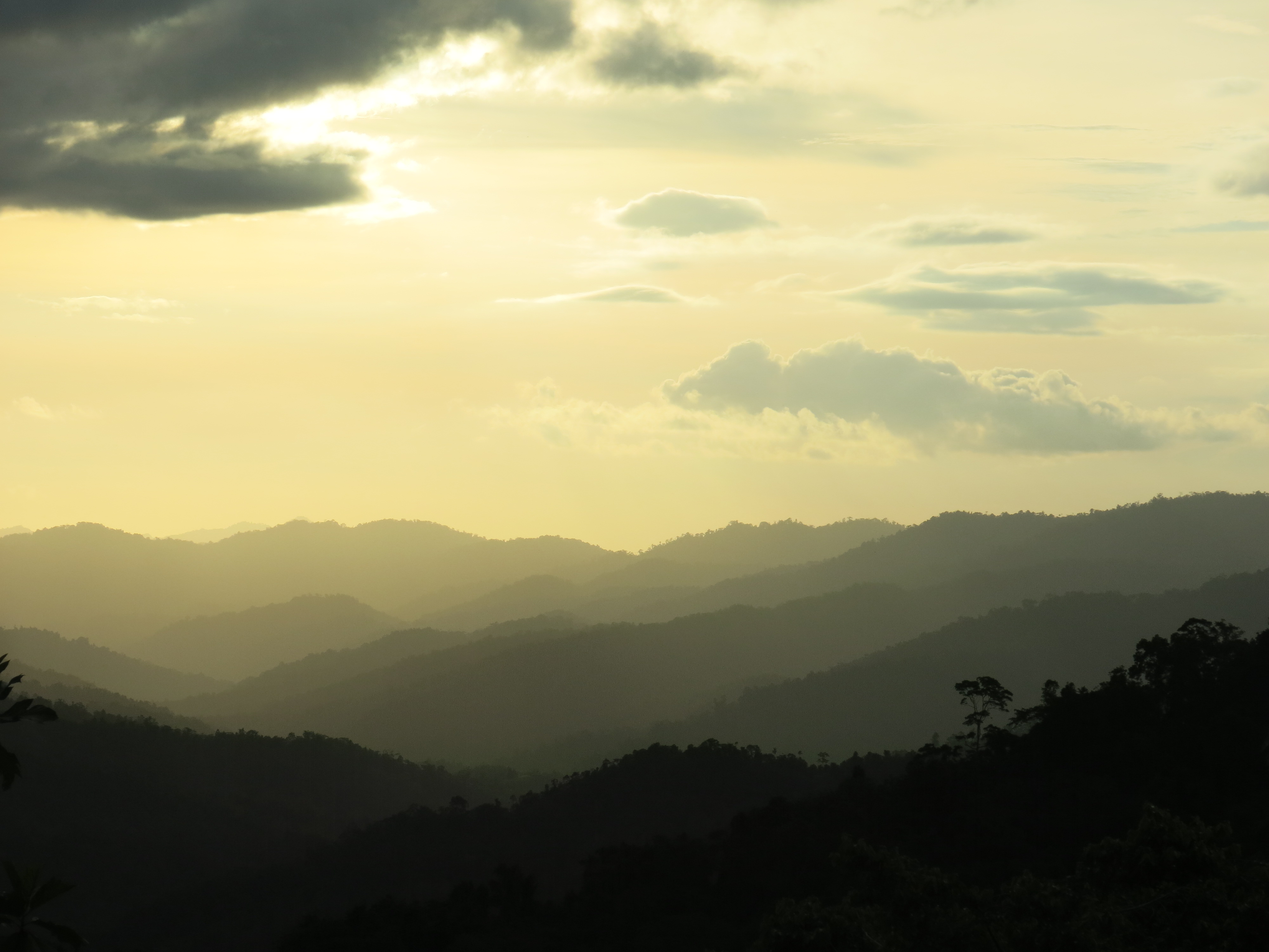
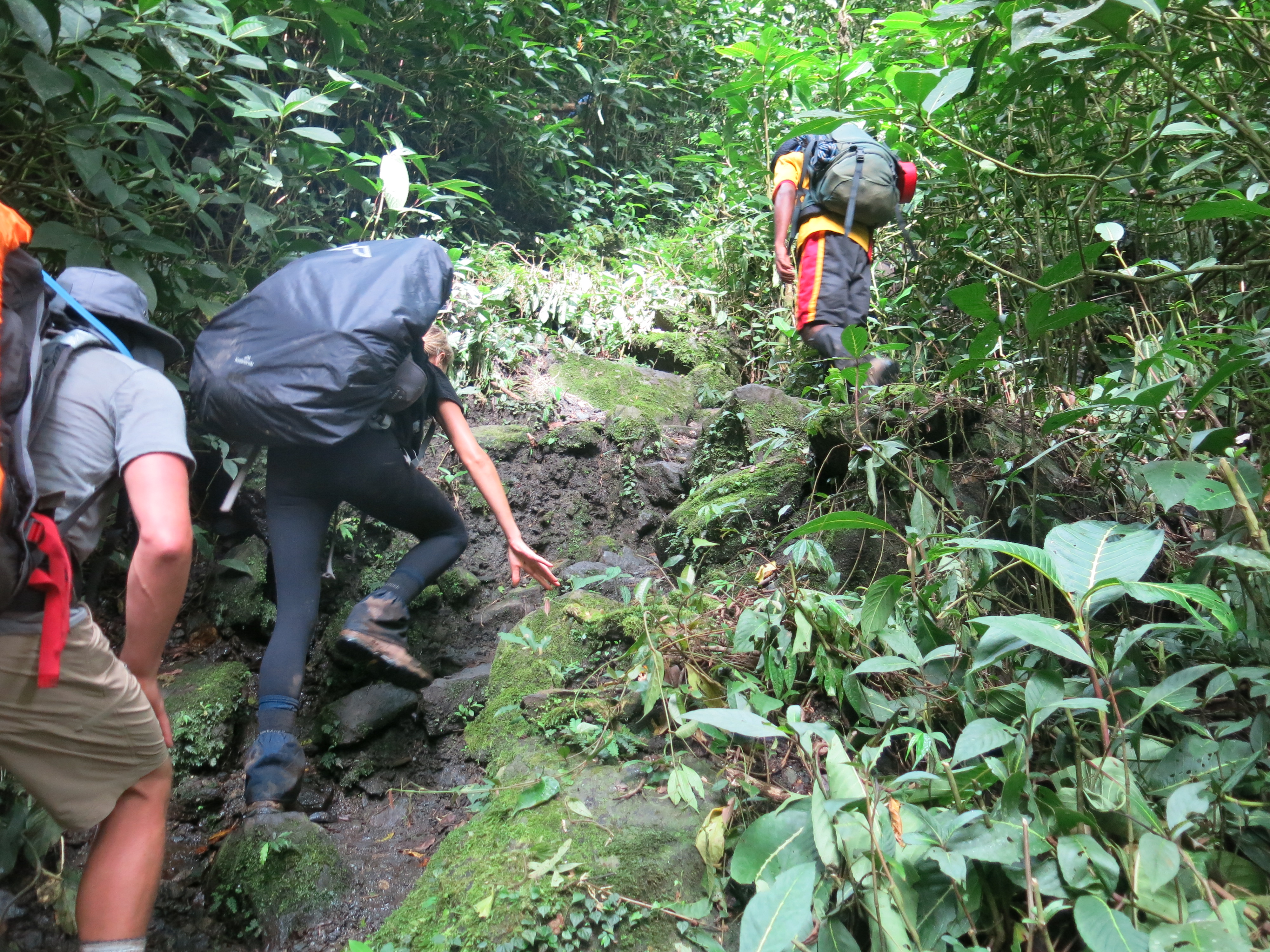
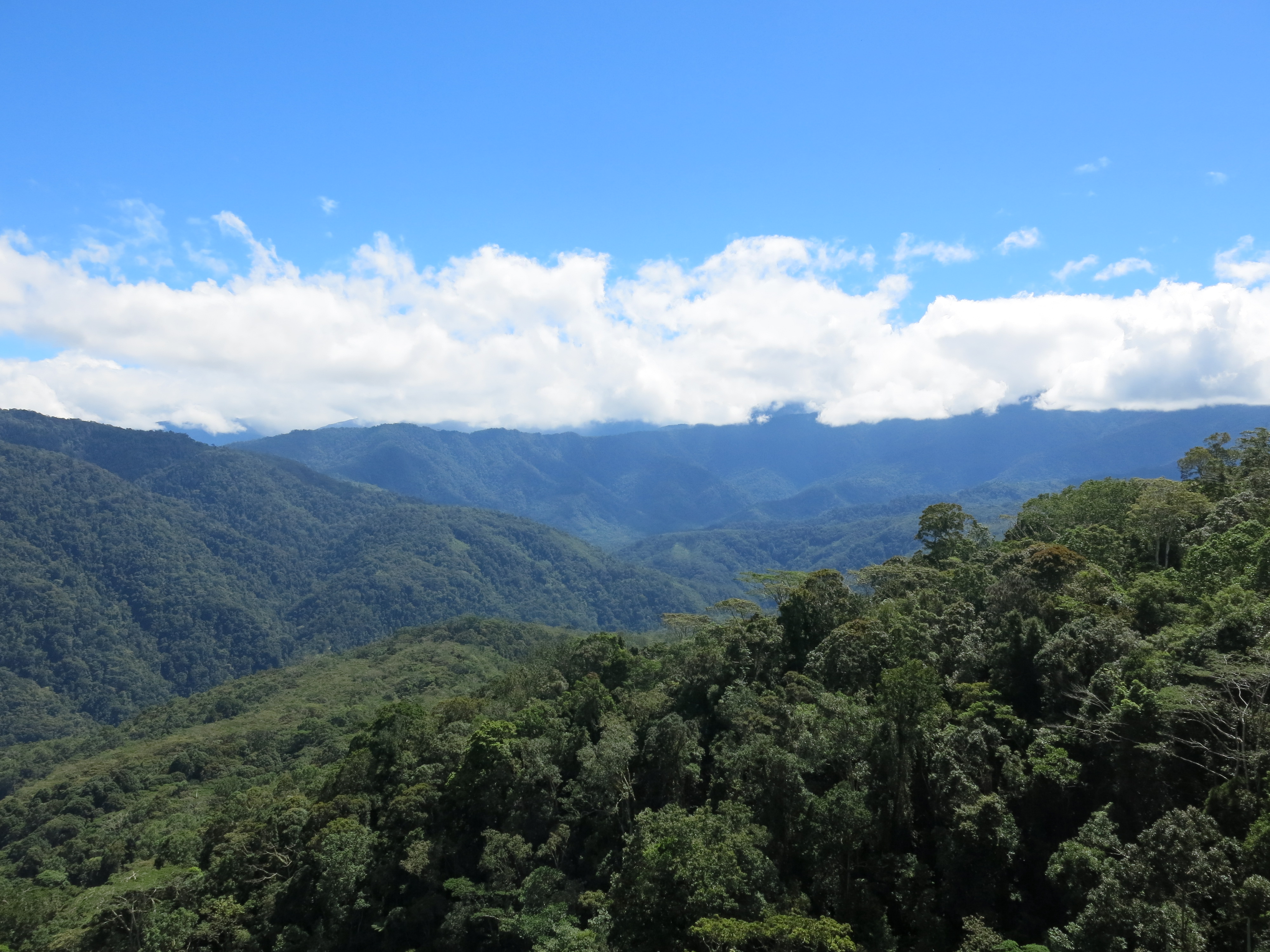
Last day of this trek. The physical exhaustion is one I struggle to put into words. The relentlessness of the Ranges both on body and mind is indescribable. Every time you think you’ve reach a peak on ascent, it’s never the top. It just keeps going and going and going.
18 river crossings and it was easier to walk through the knee deep rivers with hiking boots and socks on than to take them off and deal with than patching the now several blisters on my feet.
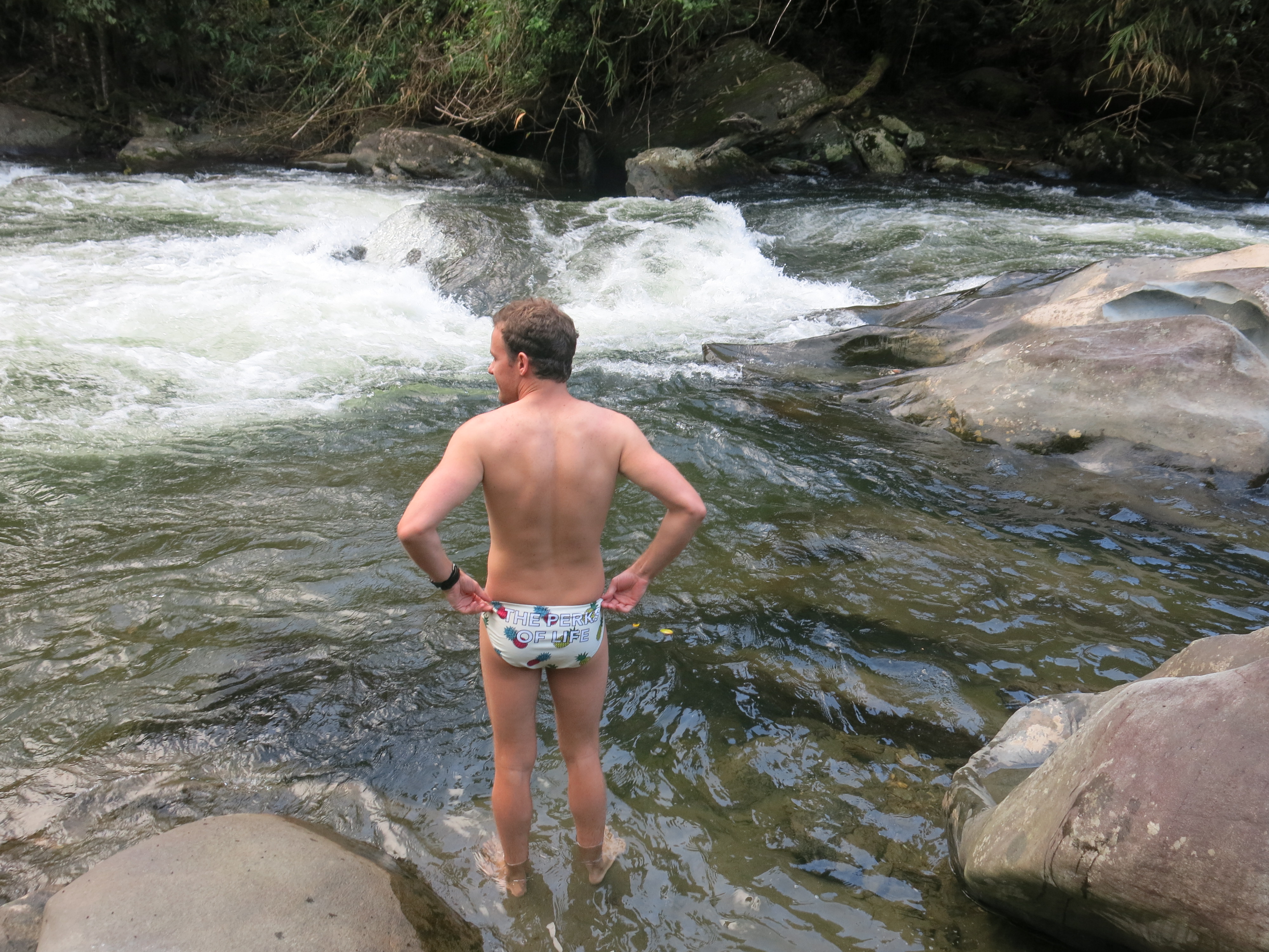
Lunch at Goldie River where we swam among the rapids and tried Beetlenut (Google it). It’s what makes all the locals’ teeth red.
On the last ascent before Ower’s Corner, i.e. the finish line, I met the world record holder for the fastest person to get through the Kokoda Track. Brendon, a local PNG bloke, managed to get through the Track in under 17 hours. Absolutely insane. The last ascent took us 45 minutes. It took him less than 10 minutes.
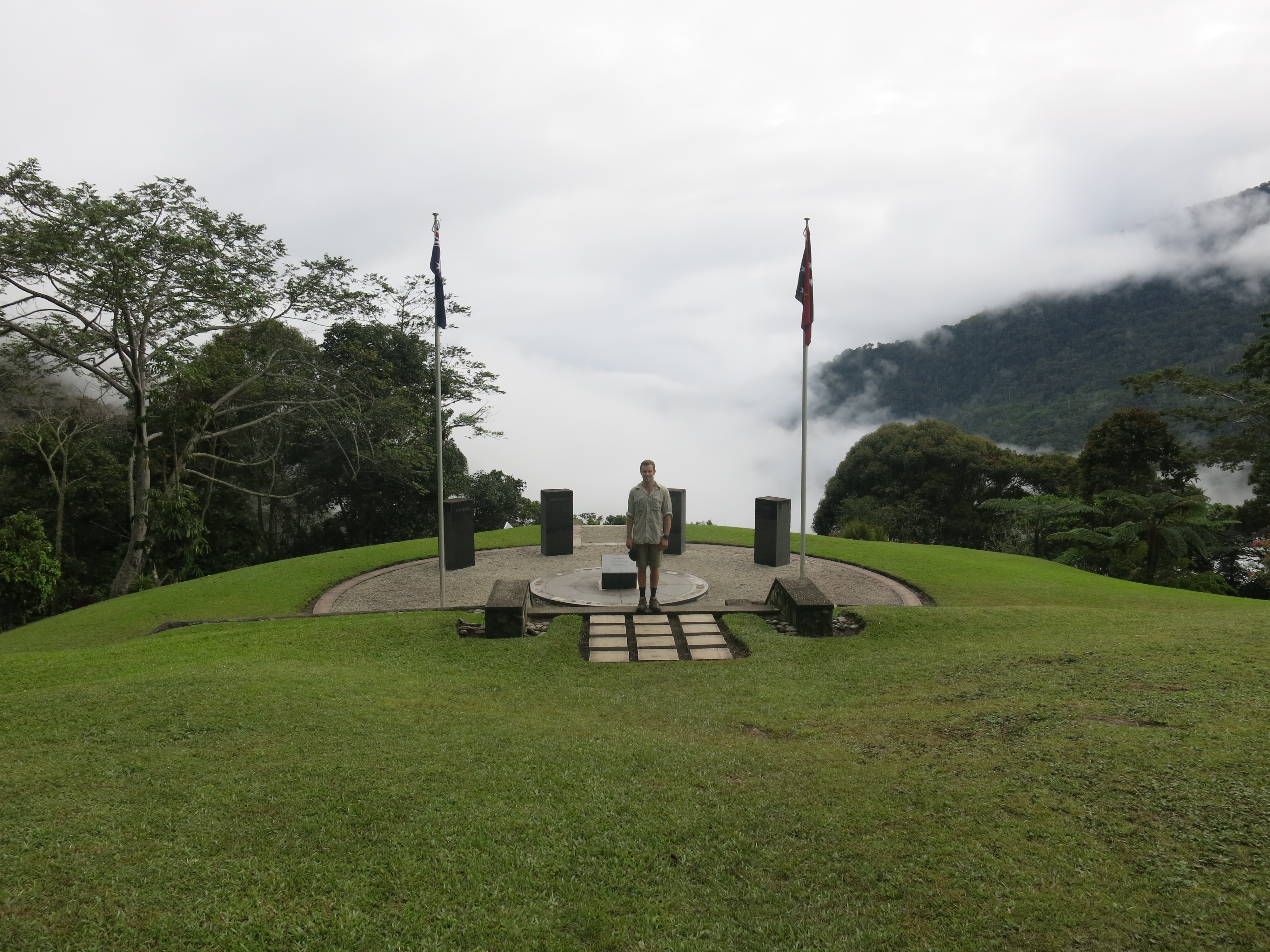
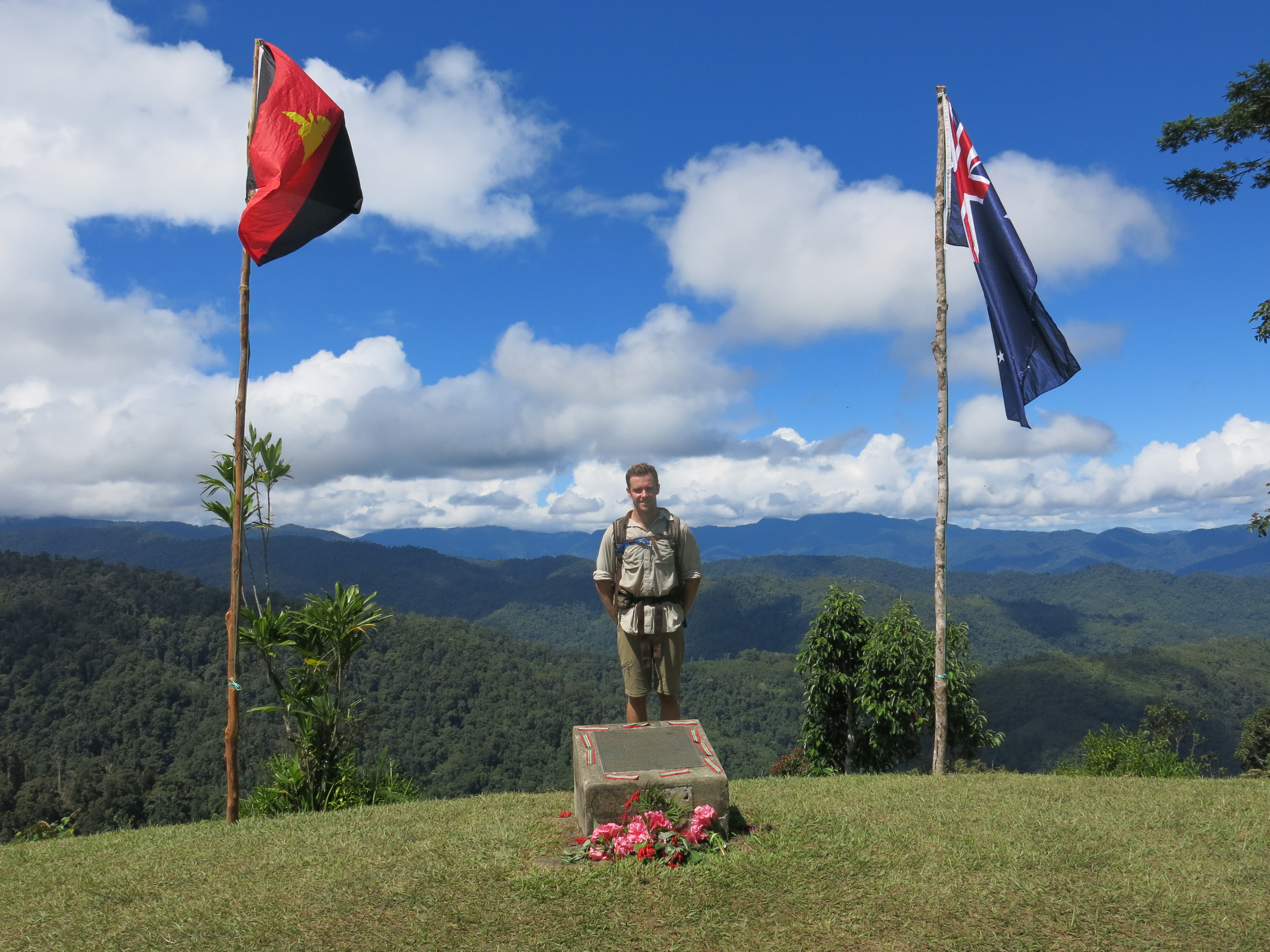
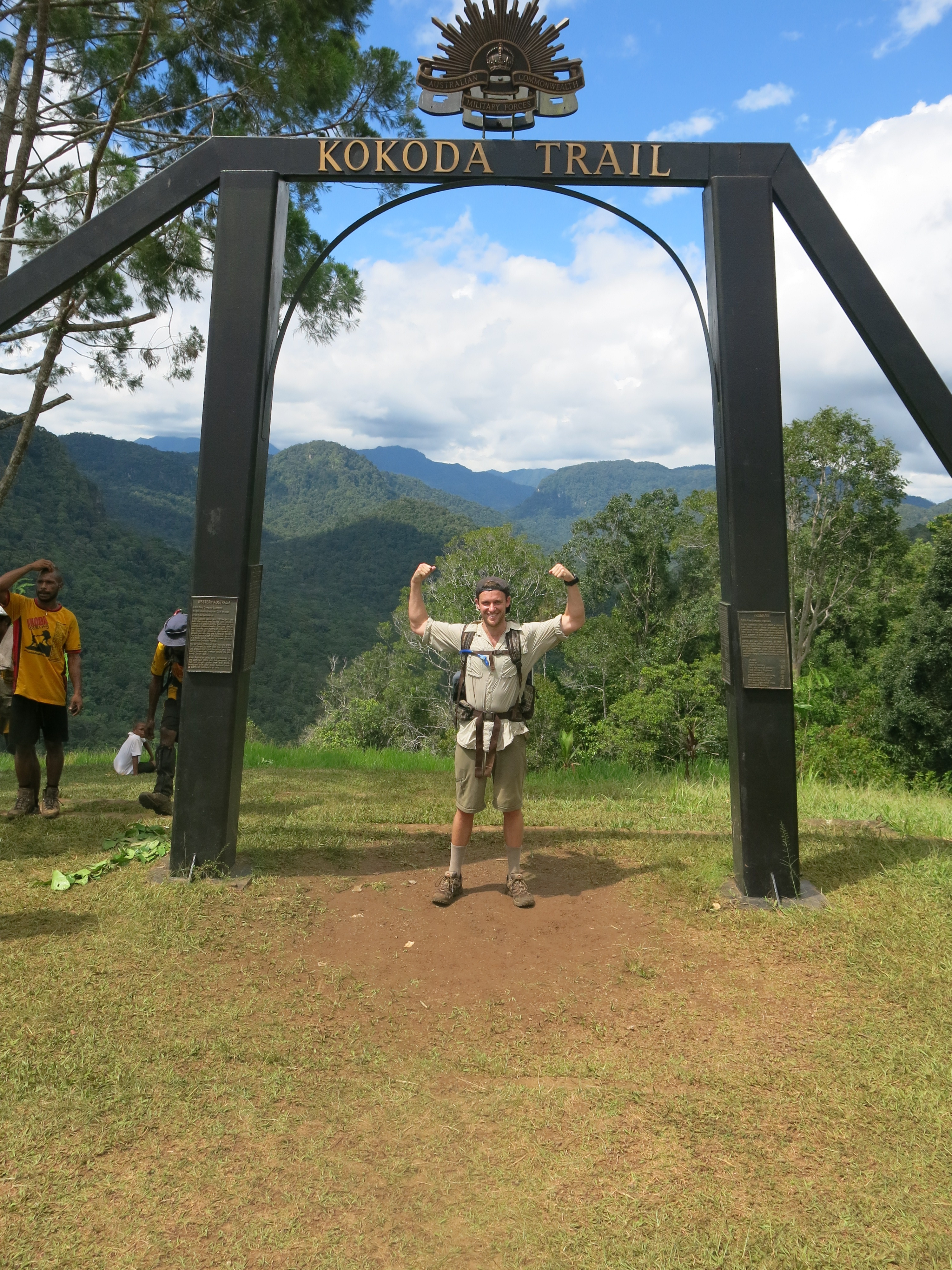
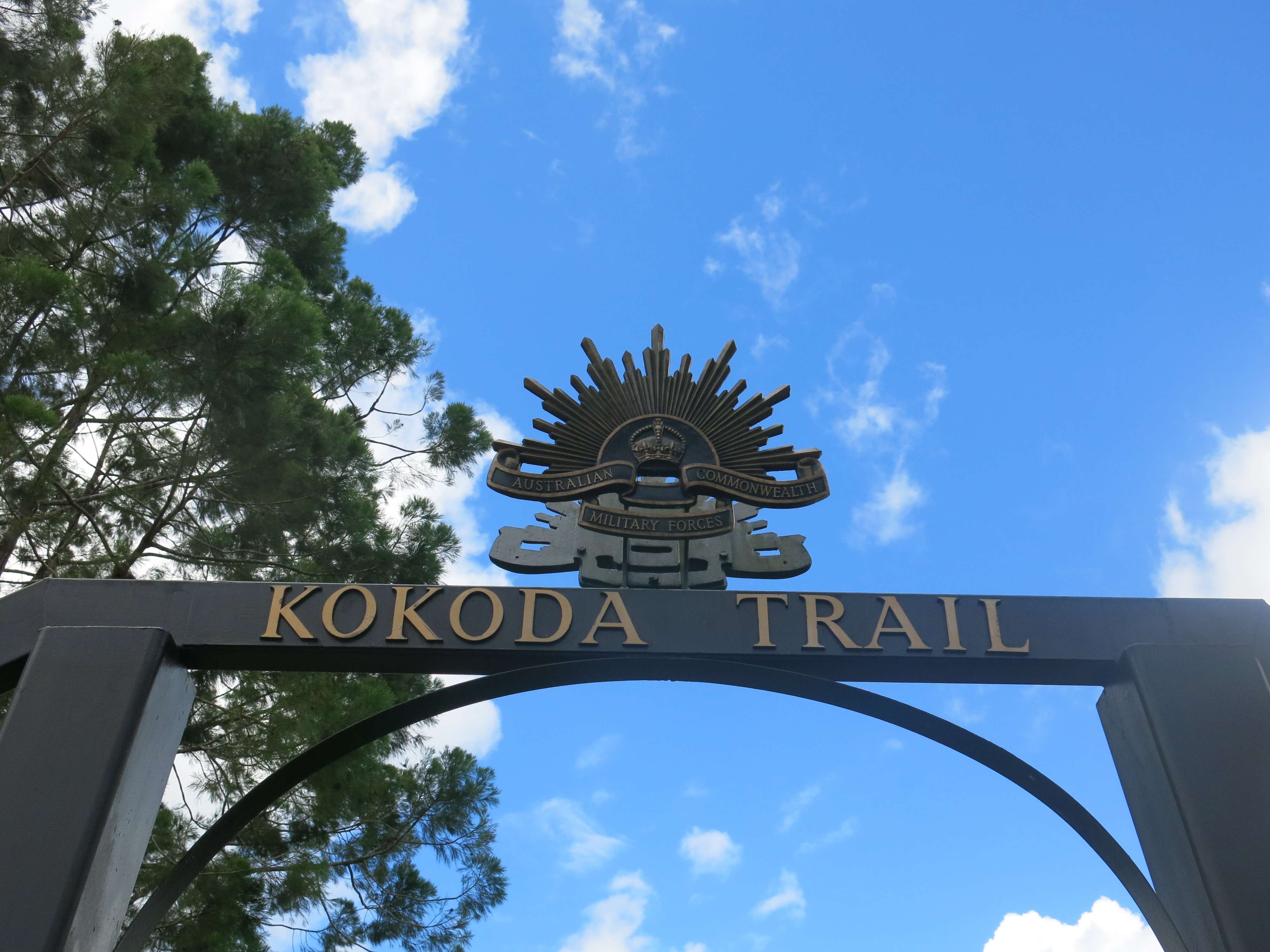
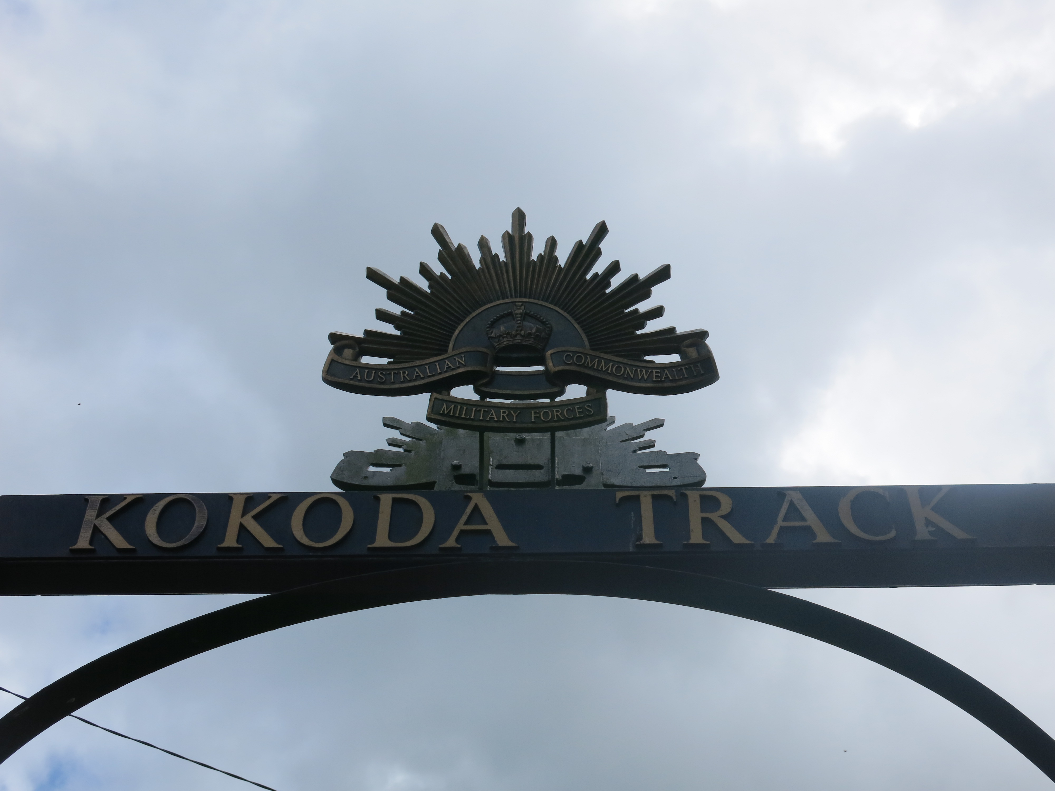
Ower’s Corner. Reaching the top and walking through the arches that said ‘Kokoda Trail’ (American) on one side and ‘Kokoda Track’ (Australian) in the other, was such an overwhelming feeling. I was off that god forsaken track but that was only a moment in time and nothing compared to what our ancestors went through. Looking back over the Ranges, I was emotional, thinking about how many people died and the hell they endured so I could sit there having this thought.
A few beers were bad back at the hotel in Port Moresby to celebrate the completion of the trek but also in honour of those who sacrificed themselves so we could do exactly what we were commemorating them for.
Day 7
Anzac Day.
No trekking today.
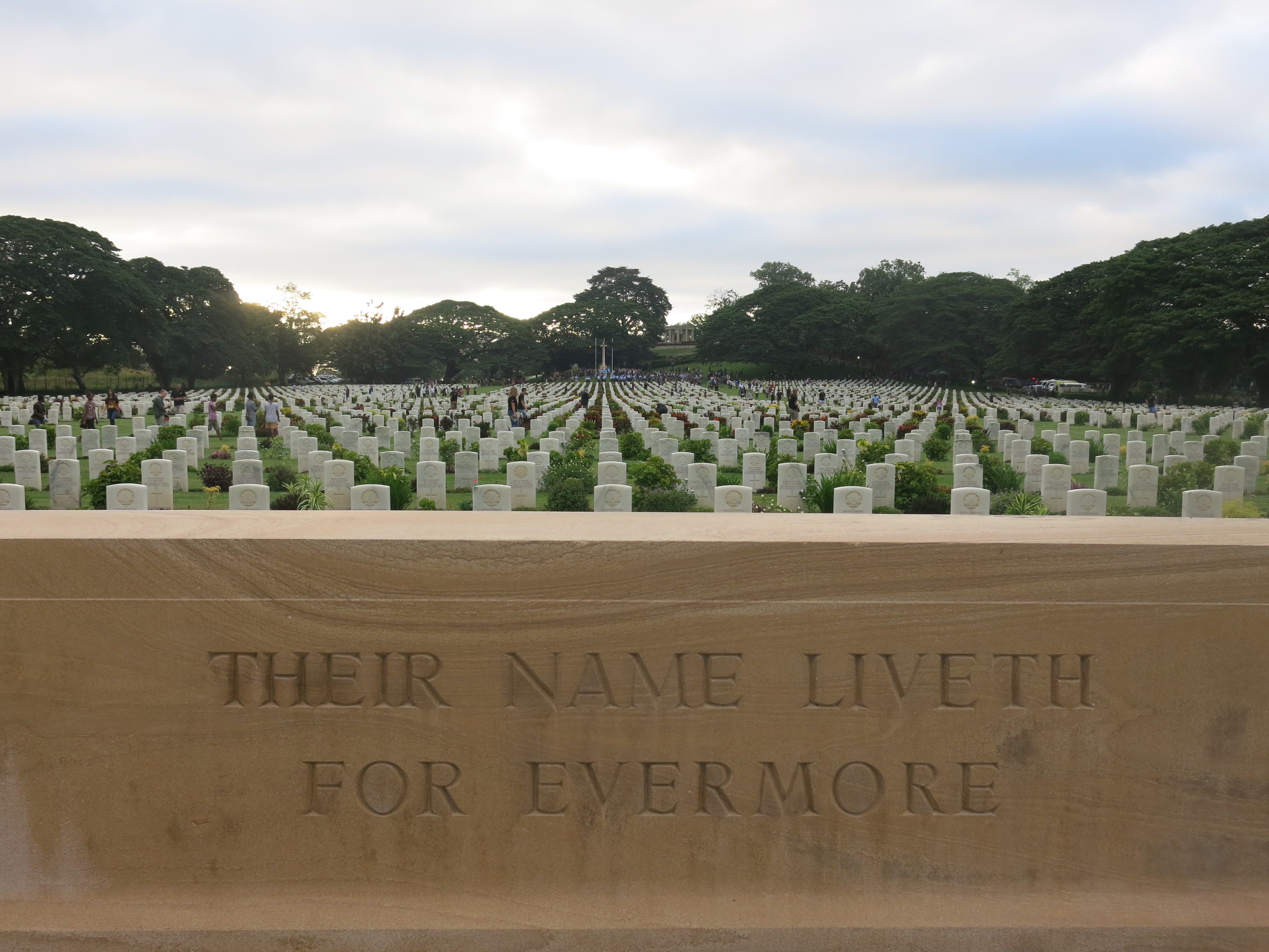
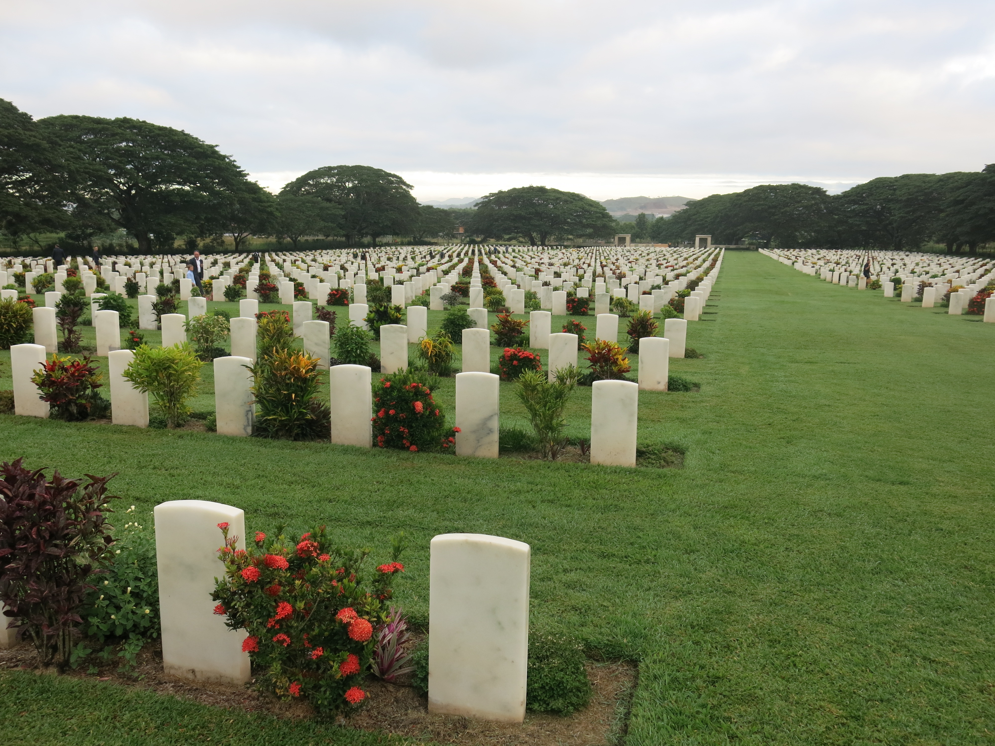
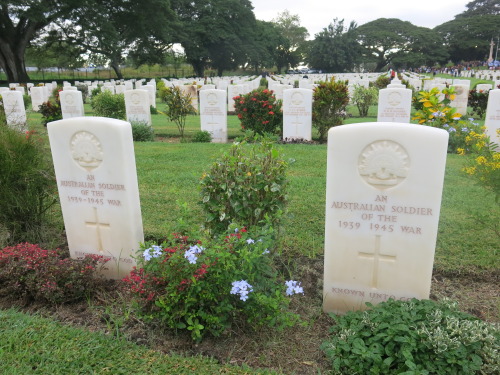
A bus ride to Bomana War Memorial in Port Moresby to commemorate those fallen who fought for our freedom and a land as we know it today.
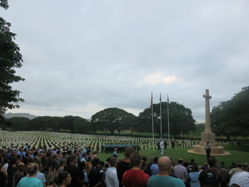
The most important day of the year. The commemoration of those who sacrificed their own lives for our freedom and for us to enjoy the lives we have as we know it today.
From what I have read of the actions of the Diggers who fought across the Owen Stanley Ranges of Papua New Guinea, these men would not have considered themselves hero’s but what they did was heroic. Nor would they consider themselves brave or courageous, yet they portrayed bravery and courage. Their strength and mateship toward each other, along with these other characteristics, is what shapes the identity of Australians and is what puts tears of pride in my eyes.
After completing the Kokoda Track, knowing that many of the soldiers were younger than me, is an absolute inspiration and tragedy in the same breath.
If you made it this far down the blog post and if you ever think about doing it, you won’t be wasting your time or money.
A video below so you can get a little perspective on just how tough the trail is.